Paranhos, Mato Grosso do Sul
Municipality in Central-West, Brazil

Flag

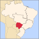
Location in Mato Grosso do Sul state
(2020 [1])
Paranhos is a municipality located in the Brazilian state of Mato Grosso do Sul. Its population was 14,404 (2020) and its area is 1,302 km2. It is known for having registered snowfalls at least two times (in 1975 and 2013), an extremely rare phenomenon in Brazil outside the regions of South and Southeast.
References
- ^ IBGE 2020
- v
- t
- e

Capital: Campo Grande
Centro Norte de Mato Grosso do Sul
| Alto Taquari |
|
|---|---|
| Campo Grande |
|
Leste de Mato Grosso do Sul
| Cassilândia | |
|---|---|
| Nova Andradina | |
| Paranaíba | |
| Três Lagoas |
Pantanal Sul Mato-Grossense
| Aquidauana | |
|---|---|
| Baixo Pantanal |
Sudoeste de Mato Grosso do Sul
| Bodoquena | |
|---|---|
| Dourados | |
| Iguatemi |
 | This Mato Grosso do Sul, Brazil location article is a stub. You can help Wikipedia by expanding it. |
- v
- t
- e


