Água Clara
You can help expand this article with text translated from the corresponding article in Portuguese. (February 2018) Click [show] for important translation instructions.
- View a machine-translated version of the Portuguese article.
- Machine translation, like DeepL or Google Translate, is a useful starting point for translations, but translators must revise errors as necessary and confirm that the translation is accurate, rather than simply copy-pasting machine-translated text into the English Wikipedia.
- Consider adding a topic to this template: there are already 1,528 articles in the main category, and specifying
|topic=will aid in categorization. - Do not translate text that appears unreliable or low-quality. If possible, verify the text with references provided in the foreign-language article.
- You must provide copyright attribution in the edit summary accompanying your translation by providing an interlanguage link to the source of your translation. A model attribution edit summary is
Content in this edit is translated from the existing Portuguese Wikipedia article at [[:pt:Água Clara]]; see its history for attribution. - You may also add the template
{{Translated|pt|Água Clara}}to the talk page. - For more guidance, see Wikipedia:Translation.
Municipality in Central-West, Brazil

Flag

Coat of arms

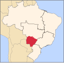
Location in Mato Grosso do Sul state
(2020 [1])
Água Clara is a municipality located in the Brazilian state of Mato Grosso do Sul. Its population was 15,776 (2020) and its area is 11,031 km2 (4,259 sq mi).
Geography
The municipality of Água Clara is located in the south of the Midwest region of Brazil. It is located at latitude 20º26'53 ” south and longitude 52º52'40” west. It has just over 14,000 inhabitants. It is 204 km from the state capital (Campo Grande) and 868 km from the federal capital (Brasília).
References
- ^ IBGE 2020
- v
- t
- e

Capital: Campo Grande
Centro Norte de Mato Grosso do Sul
| Alto Taquari | |
|---|---|
| Campo Grande |
|
Leste de Mato Grosso do Sul
| Cassilândia | |
|---|---|
| Nova Andradina | |
| Paranaíba | |
| Três Lagoas |
Pantanal Sul Mato-Grossense
| Aquidauana | |
|---|---|
| Baixo Pantanal |
Sudoeste de Mato Grosso do Sul
| Bodoquena | |
|---|---|
| Dourados | |
| Iguatemi |
 | This Mato Grosso do Sul, Brazil location article is a stub. You can help Wikipedia by expanding it. |
- v
- t
- e


