Paranaíba
Municipality in Central-West, Brazil

Flag

Seal
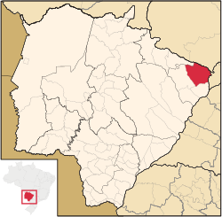
Location of Paranaíba
 Brazil
 Mato Grosso do Sul
 (2020 [1])
Paranaíba is the easternmost municipality in the Brazilian state of Mato Grosso do Sul. Its population was 42,276 (2020) and its area is 5,402.778 km2.
Climate
| Climate data for Paranaíba (1981–2010) | |||||||||||||
|---|---|---|---|---|---|---|---|---|---|---|---|---|---|
| Month | Jan | Feb | Mar | Apr | May | Jun | Jul | Aug | Sep | Oct | Nov | Dec | Year |
| Mean daily maximum °C (°F) | 31.5 (88.7) | 31.9 (89.4) | 31.6 (88.9) | 31.1 (88.0) | 28.6 (83.5) | 28.2 (82.8) | 29.1 (84.4) | 31.5 (88.7) | 32.2 (90.0) | 32.8 (91.0) | 32.2 (90.0) | 31.7 (89.1) | 31.0 (87.8) |
| Daily mean °C (°F) | 25.7 (78.3) | 25.9 (78.6) | 25.7 (78.3) | 24.8 (76.6) | 21.7 (71.1) | 20.9 (69.6) | 21.2 (70.2) | 23.3 (73.9) | 24.8 (76.6) | 26.1 (79.0) | 26.0 (78.8) | 25.8 (78.4) | 24.3 (75.7) |
| Mean daily minimum °C (°F) | 21.6 (70.9) | 21.6 (70.9) | 21.3 (70.3) | 19.7 (67.5) | 16.0 (60.8) | 14.8 (58.6) | 14.4 (57.9) | 16.3 (61.3) | 18.8 (65.8) | 20.8 (69.4) | 21.1 (70.0) | 21.4 (70.5) | 19.0 (66.2) |
| Average precipitation mm (inches) | 304.6 (11.99) | 185.4 (7.30) | 196.7 (7.74) | 72.0 (2.83) | 48.6 (1.91) | 22.2 (0.87) | 14.3 (0.56) | 15.5 (0.61) | 58.4 (2.30) | 105.5 (4.15) | 141.6 (5.57) | 241.4 (9.50) | 1,406.2 (55.36) |
| Average precipitation days (≥ 1.0 mm) | 18 | 12 | 12 | 5 | 4 | 2 | 2 | 2 | 6 | 8 | 11 | 16 | 98 |
| Average relative humidity (%) | 77.6 | 75.8 | 76.0 | 70.4 | 68.1 | 64.8 | 56.5 | 51.0 | 56.4 | 61.5 | 67.5 | 73.8 | 66.6 |
| Mean monthly sunshine hours | 191.3 | 199.8 | 223.0 | 242.3 | 228.8 | 214.9 | 242.8 | 255.0 | 210.7 | 223.4 | 226.3 | 204.6 | 2,662.9 |
| Source: Instituto Nacional de Meteorologia[3] | |||||||||||||
References
Wikimedia Commons has media related to Paranaíba.
Authority control databases | |
|---|---|
| International |
|
| National |
|
- v
- t
- e


