Douradina, Mato Grosso do Sul
Municipality in Mato Grosso do Sul, Brazil

Flag

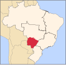
Location in Mato Grosso do Sul and Brazil
 Brazil
 Mato Grosso do Sul
 (2020 [1])
Douradina is a municipality located in the Brazilian state of Mato Grosso do Sul. Its population was 5,975 (2020) and its area is 281 km2, which makes it the smallest municipality in the state.
References
- ^ IBGE 2020
- v
- t
- e
Capital: Campo Grande
Centro Norte de Mato Grosso do Sul
| Alto Taquari | |
|---|---|
| Campo Grande |
|
Leste de Mato Grosso do Sul
| Cassilândia | |
|---|---|
| Nova Andradina | |
| Paranaíba | |
| Três Lagoas |
Pantanal Sul Mato-Grossense
| Aquidauana | |
|---|---|
| Baixo Pantanal |
Sudoeste de Mato Grosso do Sul
| Bodoquena | |
|---|---|
| Dourados | |
| Iguatemi |
 | This Mato Grosso do Sul, Brazil location article is a stub. You can help Wikipedia by expanding it. |
- v
- t
- e


