Vangaindrano (district)
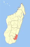
Place in Atsimo-Atsinanana, Madagascar
23°21′S 47°36′E / 23.350°S 47.600°E / -23.350; 47.600 Madagascar
 (2020)[1]
320
Vangaindrano is a district of Atsimo-Atsinanana in Madagascar. The area is 4,817 km2 (1,860 sq mi) and the population was estimated to be 376,110 in 2020.[2][3]
Municipalities
The district is further divided into 28 municipalities:
- Ambatolava
- Ambongo
- Amparihy Est
- Ampasimalemy
- Ampataka
- Anilobe
- Bekaraoka
- Bevata
- Fenoambany
- Iara
- Isahara
- Karimbary
- Lohafary
- Lopary
- Manambondro
- Marokibo
- Masianaka
- Matanga
- Ranomena
- Sandravinany
- Soamanova
- Tsianofana
- Tsiately
- Vangaindrano
- Vatanato
- Vohimalaza
- Vohipaho
- Vohitrambo
Geography
Vangaindrano is near the mouth of the Mananara River at the southern part of the east coast.
Roads
It's connected to the north by National Road RN 12 to Farafangana that is situated at a distance of 75 km in the North. The road continues south as National Road 12a to Fort Dauphin but this section can hardly be by ordinary vehicles, due to its bad condition and lack of bridges..
- RN T18 to Nosifeno and the Midongy du sud National Park.
Nature
The Midongy Atsimo National Park is situated at 90 km from Vangaindrano and the Manombo Reserve, halfway to Farafangana.
References
- ^ TROISIEME RECENSEMENT GENERAL DE LA POPULATION ET DE L’HABITATION
- ^ REPOBLIKAN’I MADAGASIKARA:Tanindrazana – Fahafahana – Fandrosoana (PDF). MINISTERE DE L’AGRICULTURE, DE L’ELEVAGE ET DE LA PECHE. October 2007. pp. 42–44.
- ^ "Madagascar: Administrative Division". citypopulation. Retrieved 10 June 2018.
- v
- t
- e
Capital: Farafangana
- Ambalatany
- Ambalavato
- Ambohigogo
- Ambohimandroso
- Amporoforo
- Ankarana Miraihina
- Anosivelo
- Anosy Tsararafa
- Antsiranambe
- Beretra Bevoay
- Efatsy Anandroza
- Etrotroka Sud
- Evato
- Farafangana
- Fenoarivo
- Iabohazo
- Ihorombe
- Ivandrika
- Mahabo Mananivo
- Mahafasa Centre
- Mahavelo
- Maheriraty
- Manambotra Sud
- Marovandrika
- Sahamadio
- Tangainony
- Tovona
- Vohilengo
- Vohimasy
- Vohitromby
5 districts; 86 communes
Wikimedia Commons has media related to Vangaindrano.
 | This Madagascar location article is a stub. You can help Wikipedia by expanding it. |
- v
- t
- e


