Mường Thanh
Ward in Điện Biên, Vietnam
Mường Thanh | |
|---|---|
Ward | |
| Country |  Vietnam Vietnam |
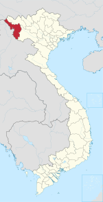
| Province | Điện Biên |
| District | Điện Biên Phủ |
| Area | |
| • Total | 1.7231 km2 (0.6653 sq mi) |
| Population (2005) | |
| • Total | 11,740 |
| • Density | 6,813/km2 (17,650/sq mi) |
| Time zone | UTC+07:00 (Indochina Time) |
Mường Thanh is a ward (phường) of Điện Biên Phủ in Điện Biên Province in northwestern Vietnam. It was a township of Điện Biên District before it was incorporated into Điện Biên Phủ city.
Mường Thanh is named after Muang Theng or Müang Thaeng, which was, according to the Khun Borom creation myth, the original home of the Tai peoples (Lao, Thai, Shan, upland Tai peoples).
Until the 1950s, Mường Thanh was the centre of an autonomous chiefdom of the Tai Dam ("Black Tai"), one of the 12 cantons of the confederation Sip Song Chau Tai.[1]
References
- ^ David K. Wyatt (2004). Thailand: A Short History (2nd ed.). Silkworm Books. p. 6. ISBN 974-9575-44-X.
- v
- t
- e
Capital: Điện Biên Phủ
- Wards
- Him Lam
- Mường Thanh
- Nam Thanh
- Noong Bua
- Tân Thanh
- Thanh Bình
- Thanh Trường
- Communes
- Mường Phăng
- Nà Nhạn
- Nà Tấu
- Pá Khoang
- Thanh Minh
- Hẹ Muông
- Hua Thanh
- Mường Lói
- Mường Nhà
- Mường Pồn
- Na Tông
- Na Ư
- Noọng Hẹt
- Noong Luống
- Núa Ngam
- Pa Thơm
- Phu Luông
- Pom Lót
- Sam Mứn
- Thanh An
- Thanh Chăn
- Thanh Hưng
- Thanh Luông
- Thanh Nưa
- Thanh Xương
- Thanh Yên
- Mường Ảng
- Ẳng Cang
- Ẳng Nưa
- Ẳng Tở
- Búng Lao
- Mường Đăng
- Mường Lạn
- Nặm Lịch
- Ngối Cáy
- Xuân Lao
- Mường Chà
- Huổi Lèng
- Huổi Mí
- Hừa Ngài
- Ma Thì Hồ
- Mường Mươn
- Mường Tùng
- Na Sang
- Nậm Nèn
- Pa Ham
- Sa Lông
- Sá Tổng
- Tuần Giáo
- Chiềng Đông
- Chiềng Sinh
- Mường Khong
- Mường Mùn
- Mường Thín
- Nà Sáy
- Nà Tòng
- Phình Sáng
- Pú Nhung
- Pú Xi
- Quài Cang
- Quài Nưa
- Quài Tở
- Rạng Đông
- Ta Ma
- Tênh Phông
- Tỏa Tình
- Mùn Chung
21°23′13″N 103°00′56″E / 21.3869°N 103.0156°E / 21.3869; 103.0156
 | This article about a location in Điện Biên province, Vietnam is a stub. You can help Wikipedia by expanding it. |
- v
- t
- e


