Mường Pồn
Commune and village in Điện Biên, Vietnam
21°33′N 103°1′E / 21.550°N 103.017°E / 21.550; 103.017 Vietnam
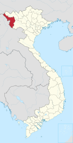
Mường Pồn is a commune (xã) and village of the Điện Biên District of Điện Biên Province, northwestern Vietnam. Less than 4 kilometres from the Lao border, it lies along National Route 12, north by road from Dien Bien Phu.
History
A small French force was located here before the Battle of Dien Bien Phu.[1] After a two-day siege, it fell to the Viet Minh on 12 December 1953, despite an attempt to relieve the garrison by Pierre Langlais.[2] The village was burned to the ground.[3]
References
- ^ Nguyêñ, Q. Thăńg; Nguyêñ, Bá Thê (1991). Nhân vật lịch sử Việt Nam, từ điển. Nhà xuá̂t bản Văn hóa. Retrieved 12 October 2011.
- ^ Nguyên Giáp Võ (1970). The military art of people's war. Monthly Review Press. p. 124. Retrieved 12 October 2011.
- ^ Pham, Thanh Tam (2005). Drawing under fire: war diary of a young Vietnamese artist. Asia Ink. p. 181. Retrieved 12 October 2011.
- v
- t
- e
Capital: Điện Biên Phủ
- Wards
- Him Lam
- Mường Thanh
- Nam Thanh
- Noong Bua
- Tân Thanh
- Thanh Bình
- Thanh Trường
- Communes
- Mường Phăng
- Nà Nhạn
- Nà Tấu
- Pá Khoang
- Thanh Minh
- Hẹ Muông
- Hua Thanh
- Mường Lói
- Mường Nhà
- Mường Pồn
- Na Tông
- Na Ư
- Noọng Hẹt
- Noong Luống
- Núa Ngam
- Pa Thơm
- Phu Luông
- Pom Lót
- Sam Mứn
- Thanh An
- Thanh Chăn
- Thanh Hưng
- Thanh Luông
- Thanh Nưa
- Thanh Xương
- Thanh Yên
- Mường Ảng
- Ẳng Cang
- Ẳng Nưa
- Ẳng Tở
- Búng Lao
- Mường Đăng
- Mường Lạn
- Nặm Lịch
- Ngối Cáy
- Xuân Lao
- Mường Chà
- Huổi Lèng
- Huổi Mí
- Hừa Ngài
- Ma Thì Hồ
- Mường Mươn
- Mường Tùng
- Na Sang
- Nậm Nèn
- Pa Ham
- Sa Lông
- Sá Tổng
- Tuần Giáo
- Chiềng Đông
- Chiềng Sinh
- Mường Khong
- Mường Mùn
- Mường Thín
- Nà Sáy
- Nà Tòng
- Phình Sáng
- Pú Nhung
- Pú Xi
- Quài Cang
- Quài Nưa
- Quài Tở
- Rạng Đông
- Ta Ma
- Tênh Phông
- Tỏa Tình
- Mùn Chung
 | This article about a location in Điện Biên province, Vietnam is a stub. You can help Wikipedia by expanding it. |
- v
- t
- e


