M'Đrăk district
You can help expand this article with text translated from the corresponding article in Vietnamese. (March 2009) Click [show] for important translation instructions.
- View a machine-translated version of the Vietnamese article.
- Machine translation, like DeepL or Google Translate, is a useful starting point for translations, but translators must revise errors as necessary and confirm that the translation is accurate, rather than simply copy-pasting machine-translated text into the English Wikipedia.
- Consider adding a topic to this template: there are already 953 articles in the main category, and specifying
|topic=will aid in categorization. - Do not translate text that appears unreliable or low-quality. If possible, verify the text with references provided in the foreign-language article.
- You must provide copyright attribution in the edit summary accompanying your translation by providing an interlanguage link to the source of your translation. A model attribution edit summary is
Content in this edit is translated from the existing Vietnamese Wikipedia article at [[:vi:M'Drắk]]; see its history for attribution. - You may also add the template
{{Translated|vi|M'Drắk}}to the talk page. - For more guidance, see Wikipedia:Translation.
District in Central Highlands, Vietnam
M'Drắk district Huyện M'Drắk | |
|---|---|
 View of M'Drak town | |
| Country |  Vietnam Vietnam |
| Region | Central Highlands |
| Province | Đắk Lắk |
| Capital | M'Drắk |
| Area | |
| • Total | 520 sq mi (1,348 km2) |
| Population (2018) | |
| • Total | 71,128 |
| Time zone | UTC+7 (Indochina Time) |
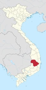
M'Drắk is a rural district (huyện) of Đắk Lắk province in the Central Highlands region of Vietnam. As of 2003 the district had a population of 56,887,[1] rising to 71,128 in 2018. The district covers an area of 1,348 km2. The district capital lies at M'Đrăk.[1] M'Đrăk is one of the most remote districts of Đắk Lắk. In the east of the province is Phoenix Pass, which connects Đắk Lắk with Khánh Hòa. The district borders the districts of Ea Kars and Krông Bông, as well as the provinces of Phú Yên and Khánh Hòa.
Ethnicity
The main ethnic groups in the district are: Êđê, Tày, Nùng, M'nong, Dao and Thái. Kinh people constitute over 50% of the population.
Administration
M'Đrăk district has 13 administrative units, which includes the communes of:
- M'Drắk township
- Ea Pil
- Cư M'Ta
- Krông Á
- Cư Króa
- Ea H'Mlay
- Ea M'doal
- Ea Riêng
- Ea Trang
- Krông Jing
- Ea Lai
- Cư Prao
- Cư San
Nature
Most areas of the district consists of the M'Đrăk plateau. Here, abundant forest resources stand on most of the Highlands that are convenient for large pasture cattle breeding. M'Đrăk is a name familiar to many people by mentioning Vietnam Hey, a song by the musician Nguyễn Cường.
M'Đrăk is located in a tropical monsoon climate, although the annual average temperature is quite low compared to other regions, the average amount of sunshine per year is 1700 hours, and the average annual rainfall is 2500 mm.
M'Đrăk has a small intensive coffee industry. It also has specialties such as avocado, durian, jackfruit, litchi and many kinds of crops such as sugar, green beans and corn.
There are breeding areas for animals such as cows, goats and horses within the district.
Places such as the Phoenix Pass, Mt Hope and the waterfalls of Đray K'nao and Ea M'doal are also located here.
Climate
| Climate data for M'Đrăk, elevation 478 m (1,568 ft) | |||||||||||||
|---|---|---|---|---|---|---|---|---|---|---|---|---|---|
| Month | Jan | Feb | Mar | Apr | May | Jun | Jul | Aug | Sep | Oct | Nov | Dec | Year |
| Record high °C (°F) | 33.9 (93.0) | 36.1 (97.0) | 36.9 (98.4) | 38.7 (101.7) | 37.3 (99.1) | 36.0 (96.8) | 34.7 (94.5) | 34.5 (94.1) | 35.2 (95.4) | 32.8 (91.0) | 32.5 (90.5) | 30.1 (86.2) | 38.7 (101.7) |
| Mean daily maximum °C (°F) | 24.5 (76.1) | 27.1 (80.8) | 30.1 (86.2) | 32.3 (90.1) | 32.4 (90.3) | 31.2 (88.2) | 30.9 (87.6) | 30.5 (86.9) | 30.1 (86.2) | 28.0 (82.4) | 25.7 (78.3) | 23.9 (75.0) | 28.9 (84.0) |
| Daily mean °C (°F) | 20.4 (68.7) | 21.7 (71.1) | 23.7 (74.7) | 25.7 (78.3) | 26.3 (79.3) | 26.3 (79.3) | 25.9 (78.6) | 25.8 (78.4) | 25.0 (77.0) | 23.8 (74.8) | 22.3 (72.1) | 20.7 (69.3) | 24.0 (75.2) |
| Mean daily minimum °C (°F) | 17.9 (64.2) | 18.2 (64.8) | 19.6 (67.3) | 21.5 (70.7) | 22.5 (72.5) | 22.8 (73.0) | 22.6 (72.7) | 22.7 (72.9) | 22.0 (71.6) | 21.3 (70.3) | 20.4 (68.7) | 18.9 (66.0) | 20.9 (69.6) |
| Record low °C (°F) | 11.6 (52.9) | 11.9 (53.4) | 12.7 (54.9) | 15.1 (59.2) | 18.4 (65.1) | 18.3 (64.9) | 18.6 (65.5) | 19.1 (66.4) | 18.5 (65.3) | 15.4 (59.7) | 13.9 (57.0) | 12.8 (55.0) | 11.6 (52.9) |
| Average precipitation mm (inches) | 55.3 (2.18) | 23.3 (0.92) | 34.3 (1.35) | 92.0 (3.62) | 191.6 (7.54) | 123.7 (4.87) | 121.8 (4.80) | 132.3 (5.21) | 220.7 (8.69) | 372.8 (14.68) | 468.3 (18.44) | 242.3 (9.54) | 2,082.1 (81.97) |
| Average rainy days | 12.9 | 7.1 | 5.9 | 8.2 | 16.9 | 15.2 | 16.0 | 18.1 | 21.6 | 22.1 | 21.3 | 20.4 | 185.7 |
| Average relative humidity (%) | 85.8 | 82.9 | 79.3 | 78.2 | 78.8 | 78.0 | 77.1 | 77.7 | 83.2 | 87.4 | 88.8 | 88.5 | 82.2 |
| Mean monthly sunshine hours | 141.6 | 182.5 | 241.4 | 245.4 | 236.2 | 207.1 | 210.8 | 198.0 | 172.6 | 140.3 | 101.0 | 96.4 | 2,172.1 |
| Source: Vietnam Institute for Building Science and Technology[2] | |||||||||||||
References
- ^ a b "Districts of Vietnam". Statoids. Retrieved March 13, 2009.
- ^ "Vietnam Institute for Building Science and Technology" (PDF). Retrieved 16 August 2023.
- v
- t
- e
- Buôn Ma Thuột city※
- Buôn Hồ town
- Buôn Đôn
- Cư Kuin
- Cư M'gar
- Ea H'Leo
- Ea Kar
- Ea Súp
- Krông Ana
- Krông Bông
- Krông Búk
- Krông Năng
- Krông Pắc
- Lắk
- M'Drắk

※ denotes provincial seat.
| ||
|---|---|---|
Capital: Buôn Ma Thuột | ||
| Buôn Ma Thuột |
|  |
| Buôn Hồ |
| |
| Buôn Đôn District | ||
| Cư Kuin District |
| |
| Cư M'gar District | ||
| Ea H'leo District | ||
| Ea Kar District | ||
| Ea Súp District |
| |
| Krông Ana District | ||
| Krông Bông District |
| |
| Krông Buk District |
| |
| Krông Năng District |
| |
| Krông Pắk District |
| |
| Lắk District |
| |
| M'Đrăk District | ||


