Socorro County
| Socorro County i New Mexico | |||
|---|---|---|---|
 | |||
| Grunnlagt | 9. jan. 1852 | ||
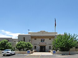
| Fylkessete | Socorro | ||
| Areal - Totalt - Land - Vann | 17 220,08 km² 17 214,1 km² 5,98 km² | ||
| Befolkning - Tetthet | 18 240 (2006) 1,06 innb./km² | ||
 Socorro County 34°01′N 106°56′V | |||
Socorro County på Commons | |||
Socorro County er et fylke i den amerikanske delstaten New Mexico. Det ligger i de sentrale delene av staten og det grenser mot Cibola County i nordvest, Valencia County i nord, Torrance County i nordøst, Lincoln County i øst, Sierra County i sør og mot Catron County.
Socorro Countys totale areal er 17 220 km² hvorav 6 km² er vann. I 2000 hadde fylket 18 078 innbyggere og administrasjonssenteret ligger i byen Socorro som også er fylkets største by. Fylkets høyeste punkt er South Baly peak i Magdalenafjellet 3 287 moh og den laveste 1 380 moh ved elven Rio Grande.
Eksterne lenker
- (en) Offisielt nettsted

- (en) Socorro County, New Mexico – kategori av bilder, video eller lyd på Commons
| |||
|---|---|---|---|
 | Bernalillo · Catron · Chaves · Cibola · Colfax · Curry · De Baca · Doña Ana · Eddy · Grant · Guadalupe · Harding · Hidalgo · Lea · Lincoln · Los Alamos · Luna · McKinley · Mora · Otero · Quay · Rio Arriba · Roosevelt · San Juan · San Miguel · Sandoval · Santa Fe · Sierra · Socorro · Taos · Torrance · Union · Valencia |  | |


