Daviess County (Indiana)
| Daviess County i Indiana | |||
|---|---|---|---|
 | |||
| Grunnlagt | 24. desember 1816[1] | ||
| Oppkalt etter | Joseph Hamilton Daveiss | ||
| Fylkessete | Washington[1] | ||
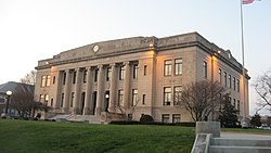
| Største by | Washington | ||
| Areal - Totalt - Land - Vann | 1 131,46 km² 1 115,4 km² 16,06 km² | ||
| Befolkning - Tetthet | 30 220 (2006) 26,71 innb./km² | ||
 Daviess County 38°42′N 87°05′V | |||
Daviess County på Commons | |||
Daviess County er et fylke i den amerikanske delstaten Indiana.
Daviess Countys totale areal er 1 131 km² hvorav 16 km² er vann. I 2010 hadde fylket 31 648[1] innbyggere og administrasjonssenteret ligger i byen Washington.[1]
Referanser
- ^ a b c d «Find a County». National Association of Counties. Besøkt 24. mai 2015.
Eksterne lenker
- Offisielt nettsted

- (en) Daviess County, Indiana – kategori av bilder, video eller lyd på Commons
 | Greene County (N) | | ||
| Knox County (V) |  | Martin County (Ø) | ||
 Daviess County, Indiana Daviess County, Indiana | ||||
 | ||||
| Pike County (SV) | Dubois County (SØ) |
| |||
|---|---|---|---|
 | Adams · Allen · Bartholomew · Benton · Blackford · Boone · Brown · Carroll · Cass · Clark · Clay · Clinton · Crawford · Daviess · Dearborn · Decatur · DeKalb · Delaware · Dubois · Elkhart · Fayette · Floyd · Fountain · Franklin · Fulton · Gibson · Grant · Greene · Hamilton · Hancock · Harrison · Hendricks · Henry · Howard · Huntington · Jackson · Jasper · Jay · Jefferson · Jennings · Johnson · Knox · Kosciusko · LaGrange · Lake · LaPorte · Lawrence · Madison · Marion · Marshall · Martin · Miami · Monroe · Montgomery · Morgan · Newton · Noble · Ohio · Orange · Owen · Parke · Perry · Pike · Porter · Posey · Pulaski · Putnam · Randolph · Ripley · Rush · St. Joseph · Scott · Shelby · Spencer · Starke · Steuben · Sullivan · Switzerland · Tippecanoe · Tipton · Union · Vanderburgh · Vermillion · Vigo · Wabash · Warren · Warrick · Washington · Wayne · Wells · White · Whitley |  | |


