County Monroe, Mississippi


County Monroe, Mississippi
Bekas Gedung Pengadilan County Monroe di Aberdeen.
Map of Mississippi highlighting County Monroe
Lokasi di negara bagian Mississippi
Map of the United States highlighting Mississippi
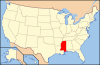
Lokasi negara bagian Mississippi di Amerika Serikat
Didirikan1821
Asal namaJames Monroe
SeatAberdeen
Kota terbesarAmory
Wilayah
 • Keseluruhan772 sq mi (1.999 km2)
 • Daratan765 sq mi (1.981 km2)
 • Perairan70 sq mi (181 km2), 0.9
Distrik kongreske-1
Zona waktuTengah
Situs webwww.monroems.com

County Monroe adalah county di perbatasan timur laut negara bagian AS Mississippi di sebelah Alabama. Pada sensus 2020, populasinya berjumlah 34.180.[1] Pusat county berada di Aberdeen.[2]

Rujukan

  1. ^ "Census - Geography Profile: Monroe County, Mississippi". United States Census Bureau. Diakses tanggal January 14, 2023. 
  2. ^ "Find a County". National Association of Counties. Diakses tanggal 2011-06-07. 
County Lee County Itawamba
County Chickasaw County Lamar, Alabama
Barat
  County Monroe, Mississippi  
Timur
County Clay County Lowndes

Templat:County Monroe, Mississippi

  • l
  • b
  • s
 Negara bagian Mississippi
Jackson (ibu kota)
Topik
  • Mississippians
  • Governors
  • Lieutenant Governors
  • Legislature
  • State Parks
  • Music
  • History
  • Geography
  • Visitor Attractions
Wilayah
  • The Delta
  • Golden Triangle
  • Gulf Coast
  • Mississippi Plain
  • Natchez District
  • Pine Belt
  • Tennessee Valley
Wilayah
metro
  • Gulfport-Biloxi
  • Hattiesburg
  • Jackson
  • Memphis (TN)
  • Pascagoula
Kota besar
  • Biloxi
  • Clarksdale
  • Clinton
  • Columbus
  • Greenville
  • Gulfport
  • Hattiesburg
  • Jackson
  • Meridian
  • Olive Branch
  • Pascagoula
  • Pearl
  • Ridgeland
  • Southaven
  • Starkville
  • Tupelo
  • Vicksburg
Kota kecil
  • Bay St. Louis
  • Brandon
  • Brookhaven
  • Canton
  • Cleveland
  • Corinth
  • Gautier
  • Greenwood
  • Grenada
  • Horn Lake
  • Indianola
  • Itta Bena
  • Laurel
  • Long Beach
  • Madison
  • McComb
  • Moss Point
  • Natchez
  • Ocean Springs
  • Oxford
  • Pass Christian
  • Picayune
  • Tunica
  • Waveland
  • West Hattiesburg (Oak Grove)
  • West Point
  • Yazoo City
County
  • Adams
  • Alcorn
  • Amite
  • Attala
  • Benton
  • Bolivar
  • Calhoun
  • Carroll
  • Chickasaw
  • Choctaw
  • Claiborne
  • Clarke
  • Clay
  • Coahoma
  • Copiah
  • Covington
  • DeSoto
  • Forrest
  • Franklin
  • George
  • Greene
  • Grenada
  • Hancock
  • Harrison
  • Hinds
  • Holmes
  • Humphreys
  • Issaquena
  • Itawamba
  • Jackson
  • Jasper
  • Jefferson
  • Jefferson Davis
  • Jones
  • Kemper
  • Lafayette
  • Lamar
  • Lauderdale
  • Lawrence
  • Leake
  • Lee
  • Leflore
  • Lincoln
  • Lowndes
  • Madison
  • Marion
  • Marshall
  • Monroe
  • Montgomery
  • Neshoba
  • Newton
  • Noxubee
  • Oktibbeha
  • Panola
  • Pearl River
  • Perry
  • Pike
  • Pontotoc
  • Prentiss
  • Quitman
  • Rankin
  • Scott
  • Sharkey
  • Simpson
  • Smith
  • Stone
  • Sunflower
  • Tallahatchie
  • Tate
  • Tippah
  • Tishomingo
  • Tunica
  • Union
  • Walthall
  • Warren
  • Washington
  • Wayne
  • Webster
  • Wilkinson
  • Winston
  • Yalobusha
  • Yazoo

Koordinat: 33°53′N 88°29′W / 33.89°N 88.49°W / 33.89; -88.49

Pengawasan otoritas Sunting ini di Wikidata
Umum
  • VIAF
    • 1
  • WorldCat (via VIAF)
Perpustakaan nasional
  • Amerika Serikat
Lain-lain
  • National Archives (US)