Steenokkerzeel
Municipality in Flemish Community, Belgium

Flag

Coat of arms
Location of Steenokkerzeel


Steenokkerzeel
Location in Belgium 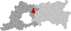
Location of Steenokkerzeel in Flemish Brabant

 Belgium
 (2018-01-01)[1]
1820
23081
Steenokkerzeel (Dutch pronunciation: [ˌsteːnˈɔkərzeːl]) is a municipality located in the Belgian province of Flemish Brabant. The municipality comprises the towns of Melsbroek, Perk and Steenokkerzeel proper. On December 31, 2010 Steenokkerzeel had a total population of 11,580. The total area is 23.46 km² which gives a population density of 493 inhabitants per km². (Steenokkerzeel: 6.333 inhabitants, Melsbroek 2.508 inhabitants, Perk 2.739 inhabitants.)
Steenokkerzeel consists of the townships of Humelgem, Steenokkerzeel and Wambeek. Perk consists of the townships Perk, Huinhoven and Boekt. 't Dickt, Passiewijk and Zonnebos are the names of residential areas in Steenokkerzeel.
Education
Notable inhabitants
- Aguila (born 1937), artist, industrial designer, and founder of the “probability reality”
- Zita of Bourbon-Parma, the last Empress of Austria, Queen of Hungary, and Queen of Bohemia.
References
- ^ "Wettelijke Bevolking per gemeente op 1 januari 2018". Statbel. Retrieved 9 March 2019.
External links
 Media related to Steenokkerzeel at Wikimedia Commons
- (in Dutch) Official website
Places adjacent to Steenokkerzeel | ||||||||||||||||
|---|---|---|---|---|---|---|---|---|---|---|---|---|---|---|---|---|
| ||||||||||||||||


- v
- t
- e
- Affligem
- Asse
- Beersel
- Bever
- Dilbeek
- Drogenbos
- Galmaarden
- Gooik
- Grimbergen
- Halle
- Herne
- Hoeilaart
- Kampenhout
- Kapelle-op-den-Bos
- Kraainem
- Lennik
- Liedekerke
- Linkebeek
- Londerzeel
- Machelen
- Meise
- Merchtem
- Opwijk
- Overijse
- Pepingen
- Roosdaal
- Sint-Genesius-Rode
- Sint-Pieters-Leeuw
- Steenokkerzeel
- Ternat
- Vilvoorde
- Wemmel
- Wezembeek-Oppem
- Zaventem
- Zemst

- Bold indicates cities
- Italic indicates municipalities with language facilities
Authority control databases | |
|---|---|
| International |
|
| Geographic |
|
 | This Flemish Brabant location article is a stub. You can help Wikipedia by expanding it. |
- v
- t
- e


