Sjona
66°18′12″N 13°17′17″E / 66.3032°N 13.2881°E / 66.3032; 13.2881Type Fjord Basin countries Norway Max. length 26 kilometres (16 mi) Max. depth 636 metres (2,087 ft)
Sjona is a fjord in Nordland county, Norway. The 26-kilometre (16 mi) fjord begins in the municipality of Rana and flows to the west through Nesna and Lurøy municipalities into the sea. The islands of Handnesøya and Tomma lie at the mouth of the fjord. The deepest part of the fjord reaches 636 metres (2,087 ft) below sea level. Norwegian County Road 17 follows the entire coast of the fjord. Villages along the shore of the fjord include Flostrand, Mæla, and Myklebustad.[1]
Media gallery
-
 Outer part seen from the south; Handnesøya to the left
 -
 Outer part seen from the south
 -
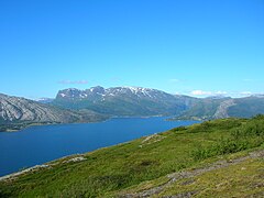
 Middle part seen from the south
 -
 Middle part seen from the south
 -
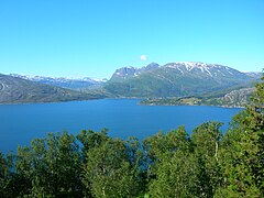
 Inner part seen from the south
 -
 Inner part seen from the south
 -
 Inner part seen from the south


References
- ^ Store norske leksikon. "Sjona" (in Norwegian). Retrieved 2011-12-28.
- v
- t
- e


