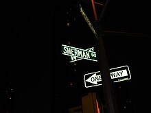
Sherman Square
Public space in Manhattan, New York

Sherman Square is a pocket park bounded by Broadway, Amsterdam Avenue, and West 70th Street on the Upper West Side of Manhattan, in New York City. It was named in 1891 for William Tecumseh Sherman who lived in the area and died that year.[1]
The park name is used to describe the neighborhood surrounding the entrances to the 72nd Street station, which are on traffic islands where Broadway and Amsterdam Avenue cross.[2]
The Sherman Square area and its much bigger neighbor Verdi Square on the north side of 72nd were dubbed “Needle Park” in the 1960s and 1970s because of illicit drug activity. This provided the title and general setting for the 1966 book by James Mills and its 1971 film adaptation The Panic in Needle Park, directed by Jerry Schatzberg and starring Al Pacino in his second role.[3][4]
The fenced-in portion of Sherman Square protecting its vegetation is only 264 square feet and is actually a scalene triangle. It is on a paved much larger triangle. The fenced area has 17 feet facing 70th Street, 35 feet facing Broadway, and 30 feet facing Amsterdam.
The name of squares for triangular pieces of land reflected the original Commissioners' Plan of 1811 which called for the area to be built according to a master grid. New York City acquired the land by condemnation in 1849 when Broadway was being built through the area at an angle and was not on the grid. Other parcels of land on Broadway that have the square name but are irregular pieces of land include Herald Square and Times Square.[1]
The park’s size diminished in 1869 when 70th Street was built.
See also
References
Wikimedia Commons has media related to Sherman Square.
- ^ a b "Sherman Square Highlights". New York City Department of Parks and Recreation.
- ^ "Sherman Square · New York, NY 10023".
- ^ Boys, Bowery (2007-11-27). "Ah, the bad ole days of Needle Park". The Bowery Boys: New York City History. Retrieved 2019-07-22.
- ^ Baum, Geraldine (2004-03-22). "Needle Park? It's been pushed into the shadows". Los Angeles Times. Retrieved 2019-07-22.
40°46′38″N 73°58′56″W / 40.77722°N 73.98222°W / 40.77722; -73.98222
- v
- t
- e
Upper West Side (including Lincoln Square, Manhattan Valley, Riverside South)
Manhattan, New York City
Culture | |||||||||||
|---|---|---|---|---|---|---|---|---|---|---|---|
| |||||||||||
Green spaces and recreation | |
|---|---|
|
Education | |||||||
|---|---|---|---|---|---|---|---|
| |||||||
Religion | |||||
|---|---|---|---|---|---|
| |||||
Transportation | |||||||
|---|---|---|---|---|---|---|---|
| |||||||
Related topics | |
|---|---|
See also: Manhattan Community Board 7
| |||||||||||||||||||||||||||||
|---|---|---|---|---|---|---|---|---|---|---|---|---|---|---|---|---|---|---|---|---|---|---|---|---|---|---|---|---|---|
| |||||||||||||||||||||||||||||
| |||||||||||||||||||||||||||||
| |||||||||||||||||||||||||||||
| |||||||||||||||||||||||||||||
| |||||||||||||||||||||||||||||

 | This article about a location in Manhattan, New York is a stub. You can help Wikipedia by expanding it. |
- v
- t
- e


