Department in Denguélé, Ivory Coast
Samatiguila Department Département de Samatiguila |
|---|
|
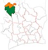
 Location in Ivory Coast. Samatiguila Department has retained the same boundaries since its creation in 2009. |
| Country |  Ivory Coast Ivory Coast |
|---|
| District | Denguélé |
|---|
| Region | Kabadougou |
|---|
| 2009 | Established as a second-level subdivision via a division of Odienné Dept |
|---|
| 2011 | Converted to a third-level subdivision |
|---|
| Departmental seat | Samatiguila |
|---|
| Government |
|---|
| • Prefect | Patrice Gueu |
|---|
| Area |
|---|
| • Total | 824 km2 (318 sq mi) |
|---|
| Population |
|---|
| • Total | 19,710 |
|---|
| • Density | 24/km2 (62/sq mi) |
|---|
| Time zone | UTC+0 (GMT) |
|---|
Samatiguila Department is a department of Kabadougou Region in Denguélé District, Ivory Coast. In 2021, its population was 19,710, making it the least-populous department in the country. The departmental seat is the settlement of Samatiguila. The sub-prefectures of the department are Kimbirila-Sud and Samatiguila.
History
Samatiguila Department was created in 2009 as a second-level subdivision via a split-off from Odienné Department.[3] At its creation, it was part of Denguélé Region.
In 2011, districts were introduced as new first-level subdivisions of Ivory Coast. At the same time, regions were reorganised and became second-level subdivisions and all departments were converted into third-level subdivisions. At this time, Samatiguila Department became part of Kabadougou Region in Denguélé District.
Notes
- ^ "Préfets de Région et de Préfets de Département (Conseil des ministres du mercredi 26 septembre 2012)", abidjan.net, 2 October 2012.
- ^ Citypopulation.de Population of the regions and departments of Ivory Coast
- ^ "Regions of Côte d'Ivoire (Ivory Coast)", statoids.com, accessed 16 February 2016.
9°49′N 7°34′W / 9.817°N 7.567°W / 9.817; -7.567
 | This Denguélé District location article is a stub. You can help Wikipedia by expanding it. |

 Ivory Coast