Saar-Warndt coal mining basin
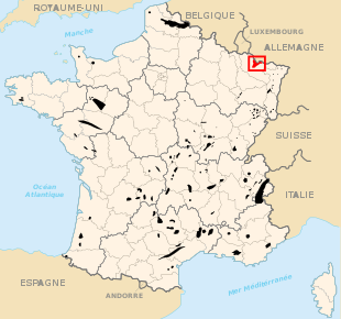
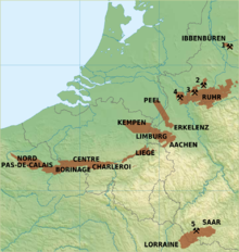
Saar-Warndt coal mining basin is an area of Germany and France. It has been shaped by two centuries of coal extraction from the start of the 19th century to the start of the 21st century; and it represents a significant period in the history of European industrialisation.
Control over the Saar coalfield passed between France and Germany during the 1900s. After World War One it was agreed in the Treaty of Versailles to be owned by France, until a plebiscite took place 15 years later where the local citizens voted to become part of Germany. Following World War Two this area was officially returned to France, however, the Saar rejoined Germany in 1957.[1]
This piece of land was valuable to these countries, especially during the coal-powered period of history. However, most of the coal in that area was mined when it belonged to France post-WW1.
-
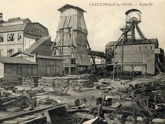 La Houve, 20th century
 -
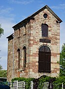 Fosse Sainte-Marte built in 1848
 -
 Fosse Folschviller 1
 -
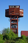
 Fosse Simon 5
 -
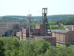
 Göttelborn
 -
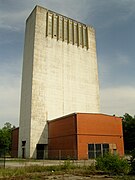
 Carreau Wendel Museum


See also
 Germany portal
 Energy portal


- Territory of the Saar Basin
- Saarland
References
- ^ "Saarland | state, Germany". Encyclopedia Britannica. Retrieved 2021-02-12.
Authority control databases | |
|---|---|
| International |
|
| Other |
|
- v
- t
- e
 | This German location article is a stub. You can help Wikipedia by expanding it. |
- v
- t
- e
 | This article about mining is a stub. You can help Wikipedia by expanding it. |
- v
- t
- e


