Ptghunk
40°09′52″N 44°21′49″E / 40.16444°N 44.36361°E / 40.16444; 44.36361
Place in Armavir, Armenia
Ptghunk Պտղունք | |
|---|---|
  Ptghunk | |
| Coordinates: 40°09′52″N 44°21′49″E / 40.16444°N 44.36361°E / 40.16444; 44.36361 | |
| Country | Armenia |
| Marz (Province) | Armavir |
| Population (2008) | |
| • Total | 1,461 |
| Time zone | UTC+4 ( ) |
| • Summer (DST) | UTC+5 ( ) |
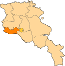
Ptghunk (Armenian: Պտղունք, also Romanized as Ptghunk’, Ptghounq, and Ptkhunk) is a village in the Armenian province of Armavir. The village is about 10 miles from Yerevan on the road to Komitas, and is close to the Zvartnots airport. The population of Ptghunk is about 1,400.
See also
- Armavir Province
References
- Ptghunk at GEOnet Names Server
- Report of the results of the 2001 Armenian Census, Statistical Committee of Armenia
- World Gazeteer: Armenia[dead link] – World-Gazetteer.com
- v
- t
- e
 Armavir Province
Capital: Armavir
- Armavir
- Metsamor
- Vagharshapat

 | This article about a location in Armavir Province, Armenia is a stub. You can help Wikipedia by expanding it. |
- v
- t
- e


