Pipestone, Manitoba
Community in Manitoba, Canada
Place in Manitoba, Canada
49°33′28″N 100°56′44″W / 49.55778°N 100.94556°W / 49.55778; -100.94556 Canada
 Manitoba
 (2006 Census[1])
R0M 1T0
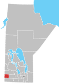
Pipestone is a community in southwestern Manitoba, Canada. Located at the corner of Highways 2 and 83, Pipestone is approximately 35 kilometres (22 mi) from either Virden or Melita, approximately 70 kilometres (43 mi) to the United States border and approximately 36 kilometres (22 mi) to the Saskatchewan border. It is mainly an agricultural area with some oil drilling nearby. Pipestone is part of the Rural Municipality of Pipestone.
History
More than 100,000 litres (22,000 imp gal; 26,000 US gal) of oil seeped into farmland near Pipestone as a result of a broken pipe in January 2012.[2]
Notable people
Pipestone was the birthplace of John Hamilton Roberts, who commanded the landing forces in the Dieppe Raid in 1942.
See also
- List of communities in Manitoba
- Pipestone Creek (Saskatchewan)
References
Wikimedia Commons has media related to Pipestone, Manitoba.
- ^ "Population and dwelling counts, for Canada and census subdivisions (municipalities), 2006 and 2001 censuses - 100% data". Statistics Canada, 2006 Census of Population. November 5, 2008. Retrieved January 30, 2009.
- ^ "Mar 2013: Tundra oil spill raises concerns". March 23, 2013.
Places adjacent to Pipestone, Manitoba | |
|---|---|


- v
- t
- e
| Former villages |
|---|
| Former RMs |
|---|


