Pic Macaya
Mountain in Haiti

Pic Macaya
Haiti
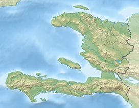
Pic Macaya (Macaya Peak) is the second-highest mountain in Haiti (after Pic la Selle), rising to an elevation of 2,347 metres (7,700 feet) above sea level. It is located in the Massif de la Hotte, 36 kilometres (22 miles) northwest of Les Cayes and 195 km (121 mi) west of Port-au-Prince. The mountain is located in the Pic Macaya National Park.
Pic Macaya is a source of water generation and has rich soil that support its dense pine forests. It has a high concentration of biodiversity with numerous endemic species and is also a nesting location for the endangered Black-capped petrel.[2]
See also
References
- ^ a b c "Central America and Caribbean Ultra-Prominence Page". peaklist.org. Retrieved 2012-10-24.
- ^ Woods CA, Sergile FE, Ottenwalder JA. Stewardship plan for the national parks and natural areas of Haiti. Florida Museum of Natural History, University of Florida; 1992.
External links
- "Pic Macaya, Haiti" on Peakbagger
- v
- t
- e


