Palmares, Pernambuco

Palmares is a city in northeastern Brazil, in the State of Pernambuco, with 63,500 inhabitants, according with IBGE 2020.[1] Its main activity is the combined field of agriculture and livestock (Portuguese: agropecuária). It received its name from the Portuguese people who named it that due to the number of palm trees in the area where run-away slaves had created approximately 16 quilombos, led by Zumbi.
Geography
- State - Pernambuco
- Region - Zona da mata Pernambucana
- Boundaries - Bonito (N); Xexéu (S); Catende (W); Joaquim Nabuco and Água Preta (E)
- Area - 386.84 km2
- Elevation - 108 m
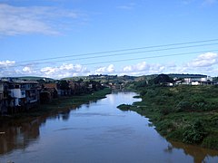
- Hydrography - Una river
- Vegetation - Subperenifólia forest
- Climate - Hot tropical and humid
- Annual average temperature - 22 c
- Distance to Recife - 120 km
Economy
The main economic activities in Palmares are based in industry, commerce and agribusiness especially, sugarcane, bananas; and creations of cattle, horses and mules.
Economic Indicators
| Population [2] | GDP x(1000 R$).[3] | GDP pc (R$) | PE |
|---|---|---|---|
| 58.819 | 305.367 | 5.391 | 0.50% |
Economy by Sector 2006
| Primary sector | Secondary sector | Service sector |
|---|---|---|
| 5.88% | 9.65% | 84.47% |
Health Indicators
| HDI (2000) | Hospitals (2007) | Hospitals beds (2007) | Children's Mortality every 1000 (2005) |
|---|---|---|---|
| 0.653 | 3 | 324 | 27.7 |
See also
References
- v
- t
- e

Capital: Recife
Agreste Pernambucano
| Alto Capibaribe | |
|---|---|
| Brejo Pernambucano | |
| Garanhuns | |
| Médio Capibaribe | |
| Vale do Ipanema | |
| Vale do Ipojuca |

Mata Pernambucana
| Mata Meridional Pernambucana | |
|---|---|
| Mata Setentrional Pernambucana | |
| Vitoria de Santo Antão |
Metropolitana de Recife
| Itamaracá | |
|---|---|
| Recife | |
| Porto de Suape | |
| Fernando de Noronha |
Sao Francisco Pernambucano
| Itaparica | |
|---|---|
| Petrolina |
Sertão Pernambucano
| Araripina | |
|---|---|
| Pajeú | |
| Salgueiro | |
| Sertão do Moxotó |
8°40′58″S 35°35′31″W / 8.68278°S 35.59194°W / -8.68278; -35.59194
Authority control databases | |
|---|---|
| International |
|
| National |
|
 | This Pernambuco, Brazil location article is a stub. You can help Wikipedia by expanding it. |
- v
- t
- e


