Otívar
Village in Granada, Spain

Flag

Seal
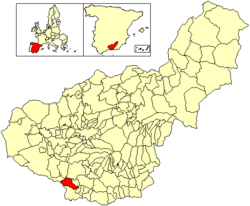
Location of Otívar
(2018)[1]
Otívar is a municipality located at 267.80 metres above sea level in the Province of Granada, Spain. According to the 2004 census (INE), the village has a population of 1,113 inhabitants.
Agriculture is Otívar's predominant economic activity (mainly tropical fruit) however, due to the dramatic scenery of the surrounding mountains, a number of northern Europeans have discovered its charms and either take rural holidays here, or in a few cases have settled here and integrated with the local population. The Sierras of Tejeda, Almijara and Alhama Natural Park are just west of the town.
Otívar contains a cross between a subtropical micro climate and a coastal mediterranean climate, creating a perfect environment for the famous "Níspero" known in English as the "loquat". The average yearly temperature is 14.80 °C (degrees Celsius). In the warmer months the average temperature is 28,80 °C (degrees Celsius) and in the colder months the average temperature is 4,50 °C (degrees Celsius).
The current mayor is Francisco Robles Carrascosa, from the political party of PP. This is the second consecutive term the mayor has won, after the PSOE´s defeat four years ago.
References
- ^ Municipal Register of Spain 2018. National Statistics Institute.
36°49′N 3°41′W / 36.817°N 3.683°W / 36.817; -3.683
- v
- t
- e
Municipalities in the province of Granada
- Agrón
- Alamedilla
- Albolote
- Albondón
- Albuñán
- Albuñol
- Albuñuelas
- Aldeire
- Alfacar
- Algarinejo
- Alhama de Granada
- Alhendín
- Alicún de Ortega
- Almegíjar
- Almuñécar
- Alpujarra de la Sierra
- Alquife
- Arenas del Rey
- Armilla
- Atarfe
- Baza
- Beas de Granada
- Beas de Guadix
- Benalúa
- Benalúa de las Villas
- Benamaurel
- Bérchules
- Bubión
- Busquístar
- Cacín
- Cádiar
- Cájar
- La Calahorra
- Calicasas
- Campotéjar
- Cáñar
- Caniles
- Capileira
- Carataunas
- Cástaras
- Castilléjar
- Castril
- Cenes de la Vega
- Chauchina
- Chimeneas
- Churriana de la Vega
- Cijuela
- Cogollos de Guadix
- Cogollos Vega
- Colomera
- Cortes de Baza
- Cortes y Graena
- Cuevas del Campo
- Cúllar
- Cúllar Vega
- Darro
- Dehesas de Guadix
- Dehesas Viejas
- Deifontes
- Diezma
- Dílar
- Dólar
- Domingo Pérez de Granada
- Dúdar
- Dúrcal
- Escúzar
- Ferreira
- Fonelas
- Fornes
- Freila
- Fuente Vaqueros
- Las Gabias
- Galera
- Gobernador
- Gójar
- Gor
- Gorafe
- Granada
- Guadahortuna
- Guadix
- Los Guájares
- Gualchos
- Güéjar Sierra
- Güevéjar
- Huélago
- Huéneja
- Huéscar
- Huétor Santillán
- Huétor-Tájar
- Huétor Vega
- Íllora
- Ítrabo
- Iznalloz
- Játar
- Jayena
- Jérez del Marquesado
- Jete
- Jun
- Juviles
- Láchar
- Lanjarón
- Lanteira
- Lecrín
- Lentegí
- Lobras
- Loja
- Lugros
- Lújar
- La Malahá
- Maracena
- Marchal
- Moclín
- Molvízar
- Monachil
- Montefrío
- Montejícar
- Montillana
- Moraleda de Zafayona
- Morelábor
- Motril
- Murtas
- Nevada
- Nigüelas
- Nívar
- Ogíjares
- Orce
- Órgiva
- Otívar
- El Padul
- Pampaneira
- Pedro Martínez
- Peligros
- La Peza
- El Pinar
- Píñar
- Pinos Genil
- Pinos Puente
- Polícar
- Polopos
- Pórtugos
- Puebla de Don Fadrique
- Pulianas
- Purullena
- Quéntar
- Rubite
- Salar
- Salobreña
- Santa Cruz del Comercio
- Santa Fe
- Soportújar
- Sorvilán
- La Taha
- Torre-Cardela
- Torrenueva Costa
- Torvizcón
- Trevélez
- Turón
- Ugíjar
- Valderrubio
- El Valle
- Valle del Zalabí
- Válor
- Vegas del Genil
- Vélez de Benaudalla
- Ventas de Huelma
- Villa de Otura
- Villamena
- Villanueva Mesía
- Villanueva de las Torres
- Víznar
- Zafarraya
- Zagra
- La Zubia
- Zújar

Authority control databases | |
|---|---|
| International |
|
| National |
|
 | This article about a location in the province of Granada is a stub. You can help Wikipedia by expanding it. |
- v
- t
- e


