Ostvorpommern

District in Mecklenburg-Western Pomerania, Germany
Coat of arms of Ostvorpommern
Coat of arms
CountryGermanyStateMecklenburg-Western PomeraniaFounded1994Disbanded2011CapitalAnklamArea
 • Total1,899 km2 (733 sq mi)Population
 (2010-12-31)
 • Total105,036 • Density55/km2 (140/sq mi)Time zoneUTC+01:00 (CET) • Summer (DST)UTC+02:00 (CEST)Vehicle registrationOVPWebsitehttp://www.kreis-ovp.de

Ostvorpommern was a Kreis (district) in the eastern part of Mecklenburg-Western Pomerania, Germany. Neighboring districts were (from east clockwise) Uecker-Randow, Mecklenburg-Strelitz, Demmin and Nordvorpommern. The Hanseatic city of Greifswald was enclosed by the district, but did not belong to it.

History

Ostvorpommern District was established on June 12, 1994 by merging the former districts of Anklam, Greifswald and Wolgast. It was merged into Vorpommern-Greifswald on 4 September 2011.

Coat of arms

Coat of arms 
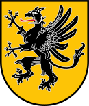
The coat of arms shows the griffin of Pomerania.

Towns and municipalities

The subdivisions of the district were (situation August 2011):

Amt-free towns Amt-free municipalities
  1. Anklam
  1. Heringsdorf
Ämter
  1. Buggenhagen
  2. Hohendorf3
  3. Krummin
  4. Lassan2
  5. Lütow
  6. Sauzin
  7. Wolgast1, 2
  8. Zemitz
  1. Bargischow
  2. Blesewitz
  3. Boldekow
  4. Bugewitz
  5. Butzow
  6. Ducherow
  7. Iven
  8. Krien
  9. Krusenfelde
  10. Liepen3
  11. Medow
  12. Neetzow3
  13. Neu Kosenow
  14. Neuendorf A3
  15. Neuendorf B3
  16. Neuenkirchen
  17. Postlow
  18. Putzar3
  19. Rossin
  20. Sarnow
  21. Spantekow1
  22. Stolpe
  1. Behrenhoff
  2. Dargelin
  3. Dersekow
  4. Diedrichshagen
  5. Hinrichshagen
  6. Levenhagen
  7. Mesekenhagen
  8. Neuenkirchen1
  9. Wackerow
  10. Weitenhagen
  • 4. Lubmin
  1. Brünzow
  2. Hanshagen
  3. Katzow
  4. Kemnitz
  5. Kröslin
  6. Loissin
  7. Lubmin1
  8. Neu Boltenhagen
  9. Rubenow
  10. Wusterhusen
  1. Karlshagen
  2. Mölschow
  3. Peenemünde
  4. Trassenheide
  5. Zinnowitz1
  1. Benz
  2. Dargen
  3. Garz
  4. Kamminke
  5. Korswandt
  6. Koserow
  7. Loddin
  8. Mellenthin
  9. Pudagla
  10. Rankwitz
  11. Stolpe auf Usedom
  12. Ückeritz
  13. Usedom1, 2
  14. Zempin
  15. Zirchow
  • 7. Züssow
  1. Bandelin
  2. Gribow
  3. Groß Kiesow
  4. Groß Polzin
  5. Gützkow2
  6. Karlsburg
  7. Klein Bünzow
  8. Kölzin3
  9. Lühmannsdorf
  10. Murchin
  11. Rubkow
  12. Schmatzin
  13. Wrangelsburg
  14. Ziethen
  15. Züssow1
1 - seat of the Amt; 2 - town; 3 - former town/municipality

References

External links

Wikimedia Commons has media related to Landkreis Ostvorpommern.
  • Official website (German)
  • Touristic website of Usedom (English, German, Polish)
  • Regional Tourist Board Vorpommern (English, German, Swedish, Polish)
  • v
  • t
  • e
Flag of Mecklenburg-Vorpommern Urban and rural districts in the state of Mecklenburg-Vorpommern in Germany Flag of Germany
Urban districtsRural districtsPre-2011 districts
Districts of German states (Full list)
  • Baden-Württemberg
  • Bavaria
  • Brandenburg
  • Bremen
  • Hesse
  • Lower Saxony
  • Mecklenburg-Vorpommern
  • North Rhine-Westphalia
  • Rhineland-Palatinate
  • Saarland
  • Saxony
  • Saxony-Anhalt
  • Schleswig-Holstein
  • Thuringia
  • v
  • t
  • e
Geography of Pomerania
Regions
Current
Former
Administration
Cities and towns
Inhabited islands
Peninsulae and headlands
Rivers
Lakes
Bays, lagoons
National parks
  • v
  • t
  • e
Administrative
Lauenburg-Bütow
classified as
Farther Pomerania
or Pomerelia
Pomerelia
(Kashubia,
Kociewie,
Tuchola Forest,
Chełmno Land)
Ecclesiastical
Roman Catholic
Historical
Extant
Protestant
Historical
Extant
Archaeological cultures
Peoples
Major demographic events
Languages and dialects
West Germanic
West Slavic
Treaties
1200–1500
1500–1700
1700–present
Authority control databases Edit this at Wikidata
International
  • VIAF
National
  • Germany

53°56′N 13°40′E / 53.93°N 13.67°E / 53.93; 13.67