National Register of Historic Places listings in Caddo County, Oklahoma

This is a list of the National Register of Historic Places listings in Caddo County, Oklahoma.
This is intended to be a complete list of the properties and districts on the National Register of Historic Places in Caddo County, Oklahoma, United States. The locations of National Register properties and districts for which the latitude and longitude coordinates are included below, may be seen in a map.[1]
There are 14 properties and districts listed on the National Register in the county.
This National Park Service list is complete through NPS recent listings posted June 14, 2024.[2]
Map all coordinates using OpenStreetMap
Download coordinates as:
- KML
- GPX (all coordinates)
- GPX (primary coordinates)
- GPX (secondary coordinates)
Current listings
| [3] | Name on the Register[4] | Image | Date listed[5] | Location | City or town | Description |
|---|---|---|---|---|---|---|
| 1 | Amphlett Brothers Drug and Jewelry Store |  | May 11, 1982 (#82003669) | Evans and Coblake Aves. 34°53′35″N 98°21′55″W / 34.893056°N 98.365278°W / 34.893056; -98.365278 (Amphlett Brothers Drug and Jewelry Store) | Apache | |
| 2 | Anadarko Armory |  | May 20, 1994 (#94000479) | 700 W. Oklahoma St. 35°04′24″N 98°15′14″W / 35.073333°N 98.253889°W / 35.073333; -98.253889 (Anadarko Armory) | Anadarko | |
| 3 | Anadarko Downtown Historic District | 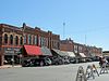 | December 10, 1990 (#82005385) | Roughly bounded by the Chicago, Rock Island and Pacific railroad line and E. 2nd and W. 3rd Sts. 35°04′32″N 98°14′36″W / 35.075556°N 98.243333°W / 35.075556; -98.243333 (Anadarko Downtown Historic District) | Anadarko | |
| 4 | Apache State Bank |  | July 17, 1972 (#72001060) | Evans and Coblake 34°53′35″N 98°21′57″W / 34.893056°N 98.365833°W / 34.893056; -98.365833 (Apache State Bank) | Apache | |
| 5 | Bridgeport Bridge | Upload image | November 30, 2020 (#100005858) | North US 281 over the South Canadian R. 35°32′29″N 98°19′15″W / 35.5415°N 98.3208°W / 35.5415; -98.3208 (Bridgeport Bridge) | Bridgeport | |
| 6 | Bridgeport Hill-Hydro OK 66 Segment | Upload image | March 3, 2004 (#04000129) | State Highway 66 from Hydro east to a spur of U.S. Route 281 35°32′29″N 98°24′43″W / 35.541389°N 98.411944°W / 35.541389; -98.411944 (Bridgeport Hill-Hydro OK 66 Segment) | Hydro | Extends into Canadian County |
| 7 | Caddo County Medicine Creek Archeological District | Upload image | March 28, 1995 (#95000235) | Address Restricted | Binger | |
| 8 | First Baptist Church (Colored) |  | December 11, 2007 (#07001263) | Junction of E. Washington Ave. and NE. 5th St. 35°04′42″N 98°14′14″W / 35.0782°N 98.2373°W / 35.0782; -98.2373 (First Baptist Church (Colored)) | Anadarko | |
| 9 | Fort Cobb Site |  | March 1, 1973 (#73001556) | 1 mile east of Fort Cobb 35°05′49″N 98°25′21″W / 35.0969°N 98.4225°W / 35.0969; -98.4225 (Fort Cobb Site) | Fort Cobb | |
| 10 | Provine Service Station |  | July 17, 1997 (#97000803) | 0.5 miles east of the junction of Interstate 40 and State Highway 58 35°32′13″N 98°34′25″W / 35.536944°N 98.573611°W / 35.536944; -98.573611 (Provine Service Station) | Hydro | |
| 11 | Randlett Park |  | September 2, 2003 (#03000878) | Washita River south to Central Boulevard and east to 7th St. 35°04′26″N 98°15′23″W / 35.073889°N 98.256389°W / 35.073889; -98.256389 (Randlett Park) | Anadarko | |
| 12 | Rock Island Passenger Station | Upload image | August 31, 2018 (#100002874) | 301 E Main St. 35°04′36″N 98°14′23″W / 35.0768°N 98.2398°W / 35.0768; -98.2398 (Rock Island Passenger Station) | Anadarko | |
| 13 | Rock Mary |  | June 22, 1970 (#70000528) | 4 miles west of Hinton 35°27′35″N 98°25′32″W / 35.459722°N 98.425556°W / 35.459722; -98.425556 (Rock Mary) | Hinton | |
| 14 | Stevens Rock Shelter | Upload image | March 28, 1995 (#95000237) | Address Restricted | Gracemont |
Former listing
| [3] | Name on the Register | Image | Date listed | Date removed | Location | City or town | Description |
|---|---|---|---|---|---|---|---|
| 1 | Black Beaver's Grave | Upload image | May 11, 1973 (#73002256) | September 1, 1975 | N of Anadarko | Anadarko vicinity | Relocated to Fort Hill cemetery in 1975. [6][7] |
See also
Wikimedia Commons has media related to National Register of Historic Places in Caddo County, Oklahoma.
- List of National Historic Landmarks in Oklahoma
- National Register of Historic Places listings in Oklahoma
References
- ^ The latitude and longitude information provided in this table was derived originally from the National Register Information System, which has been found to be fairly accurate for about 99% of listings. Some locations in this table may have been corrected to current GPS standards.
- ^ National Park Service, United States Department of the Interior, "National Register of Historic Places: Weekly List Actions", retrieved June 14, 2024.
- ^ a b Numbers represent an alphabetical ordering by significant words. Various colorings, defined here, differentiate National Historic Landmarks and historic districts from other NRHP buildings, structures, sites or objects.
- ^ "National Register Information System". National Register of Historic Places. National Park Service. March 13, 2009.
- ^ The eight-digit number below each date is the number assigned to each location in the National Register Information System database, which can be viewed by clicking the number.
- ^ "Historic Indian Scout Now Rests At Chief's Knoll". The Lawton Constitution. August 10, 1975. p. 8A. Retrieved August 16, 2022 – via Newspapers.com.
- ^ http://www.ocgi.okstate.edu/shpo/shpopic.asp?id=73002256 [dead link]
- v
- t
- e
- List of U.S. National Historic Landmarks by state:
- Alabama
- Alaska
- Arizona
- Arkansas
- California
- Colorado
- Connecticut
- Delaware
- Florida
- Georgia
- Hawaii
- Idaho
- Illinois
- Indiana
- Iowa
- Kansas
- Kentucky
- Louisiana
- Maine
- Maryland
- Massachusetts
- Michigan
- Minnesota
- Mississippi
- Missouri
- Montana
- Nebraska
- Nevada
- New Hampshire
- New Jersey
- New Mexico
- New York
- North Carolina
- North Dakota
- Ohio
- Oklahoma
- Oregon
- Pennsylvania
- Rhode Island
- South Carolina
- South Dakota
- Tennessee
- Texas
- Utah
- Vermont
- Virginia
- Washington
- West Virginia
- Wisconsin
- Wyoming
 National Register of Historic Places portal
 Category


| ||
|---|---|---|
| Anadarko |
|  |
| Apache |
| |
| Binger |
| |
| Bridgeport | ||
| Fort Cobb | ||
| Gracemont |
| |
| Hinton | ||
| Hydro | ||
See also: National Register of Historic Places listings in Caddo County, Oklahoma and List of National Historic Landmarks in Oklahoma | ||


