Mount Buffalo
Mountain in Victoria, Australia

Mount Buffalo
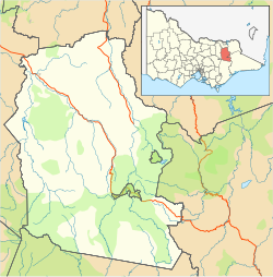
Location in Victoria
Mount Buffalo is a mountain plateau of the Australian Alps and is within the Mount Buffalo National Park in Victoria, Australia. It is located approximately 350 kilometres (220 mi) northeast of Melbourne. It is noted for its dramatic scenery.
The summit of the highest peak of the plateau, known as The Horn, has an elevation of 1,723 metres (5,653 ft) AHD.
Mount Buffalo is managed by Parks Victoria.[2]
History
Before European settlement, Mount Buffalo was visited by the Mitambuta and Taungurung people who visited to feast on Bogong moths (Agrotis infusa). Hamilton Hume and William Hovell were the first Europeans to visit the area and they named the mountain during their 1824 expedition, noting the mountain's resemblance to a giant, sleeping buffalo.[3]
In 1836, the explorer and Surveyor General of New South Wales, Thomas Mitchell visited the area and named the mountain Mount Aberdeen, unaware it had already been named Mount Buffalo.[3]
Recreation
There are extensive walking tracks across the Plateau that is studded with large granite tors. The Mount Buffalo Gorge has sheer granite cliffs that provide good views down to the Ovens Valley. The cliffs are popular for rock climbing. There is a launch ramp for hang gliders at the cliffs.
There are waterfalls on the edge of escarpment.
The Mount Buffalo Chalet provided accommodation on the mountain but is not currently operating.
During winter Mount Buffalo offers snow play and cross-country skiing.
Lake Catani on the plateau is used for canoeing, fishing and swimming.[4]
Climate
Climate data are sourced from Mount Buffalo Chalet, situated at an altitude of 1,350 metres (4,430 ft). An extreme winter rainfall peak is noted, with a large quantity falling as heavy snow.
| Climate data for Mount Buffalo Chalet (1910–1980, rainfall to 2021); 1,350 m AMSL; 36.72° S, 146.82° E | |||||||||||||
|---|---|---|---|---|---|---|---|---|---|---|---|---|---|
| Month | Jan | Feb | Mar | Apr | May | Jun | Jul | Aug | Sep | Oct | Nov | Dec | Year |
| Record high °C (°F) | 31.7 (89.1) | 31.9 (89.4) | 28.3 (82.9) | 24.4 (75.9) | 18.9 (66.0) | 15.0 (59.0) | 14.0 (57.2) | 16.0 (60.8) | 19.6 (67.3) | 21.5 (70.7) | 26.1 (79.0) | 29.5 (85.1) | 31.9 (89.4) |
| Mean daily maximum °C (°F) | 19.7 (67.5) | 19.5 (67.1) | 16.7 (62.1) | 11.8 (53.2) | 8.0 (46.4) | 5.2 (41.4) | 3.9 (39.0) | 4.8 (40.6) | 7.9 (46.2) | 11.1 (52.0) | 14.3 (57.7) | 17.5 (63.5) | 11.7 (53.1) |
| Mean daily minimum °C (°F) | 10.9 (51.6) | 11.3 (52.3) | 9.1 (48.4) | 5.5 (41.9) | 2.7 (36.9) | 0.4 (32.7) | −0.6 (30.9) | −0.2 (31.6) | 1.7 (35.1) | 3.8 (38.8) | 6.3 (43.3) | 9.1 (48.4) | 5.0 (41.0) |
| Record low °C (°F) | 0.8 (33.4) | 1.5 (34.7) | −0.8 (30.6) | −3.5 (25.7) | −7.2 (19.0) | −5.0 (23.0) | −5.6 (21.9) | −6.0 (21.2) | −6.6 (20.1) | −8.1 (17.4) | −2.5 (27.5) | −1.1 (30.0) | −8.1 (17.4) |
| Average precipitation mm (inches) | 89.3 (3.52) | 87.0 (3.43) | 99.5 (3.92) | 126.3 (4.97) | 186.9 (7.36) | 207.5 (8.17) | 225.1 (8.86) | 217.7 (8.57) | 192.1 (7.56) | 183.5 (7.22) | 129.7 (5.11) | 111.7 (4.40) | 1,856.3 (73.09) |
| Average precipitation days (≥ 0.2 mm) | 6.6 | 6.7 | 7.4 | 9.0 | 12.2 | 13.5 | 14.5 | 15.0 | 13.6 | 12.5 | 10.2 | 8.9 | 130.1 |
| Source: Australian Bureau of Meteorology; Mount Buffalo Chalet | |||||||||||||
See also
 Victoria portal
 Mountains portal


- List of mountains in Victoria
- Buffalo River (Victoria)
- Mount Buffalo National Park
References
- ^ a b c "Buffalo Plateau, Victoria". Peakbagger.com. Retrieved 4 October 2023.
- ^ Mount Buffalo National Park, Parks Victoria
- ^ a b "The Garden of the Gods - A brief history of Mount Buffalo National Park". Visit Mount Buffalo. Retrieved 26 April 2020.
- ^ Mount Buffalo National Park Archived 16 January 2014 at the Wayback Machine, Great Alpine Valleys
- v
- t
- e
- William (1,167 m or 3,829 ft)
- Difficult
- Wilson
- Zero (364 m or 1,194 ft)
| Bogong High Plains |
|
|---|---|
| Cathedral Range |
|
| Cobberas Range |
|
| Cobbler Plateau |
|
| Other |
|
mountain ranges
| Central Highlands |
|
|---|---|
| Dandenong Ranges |
|
| Pyrenees Ranges |
|
| Strzelecki Ranges |
|
| Other |
|
 | This article about a location in Victoria, Australia is a stub. You can help Wikipedia by expanding it. |
- v
- t
- e


