Menderes, İzmir
District and municipality in İzmir, Turkey
38°15′14″N 27°08′02″E / 38.254°N 27.134°E / 38.254; 27.134 (2022)[1]
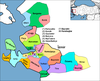
Menderes is a municipality and district of İzmir Province, Turkey.[2] Its area is 777 km2,[3] and its population is 106,173 (2022).[1]
Overview
Menderes district, which is notable for its satsumas, beautiful bays and historical riches, is 20 kilometres (12 miles) from İzmir. The ruins of Kolophon, Klaros and Notion, which are along the Menderes-Selçuk road are next to each other and make up the important archeological sites of the province. The region around Gümüldür produces the world-famous tangerine breed of satsumas. Özdere is one of the important tourism resorts of the Aegean coast. Beads of various colors and shapes which are produced by the locals in Görece village are particularly of note. The area was called Cumaovası and was a township in the Konak (Centre) district before it became a district in 1988.
Composition
There are 44 neighbourhoods in Menderes District:[4]
- Ahmetbeyli
- Akçaköy
- Altıntepe
- Ata
- Ataköy
- Barbaros
- Bulgurca
- Çakaltepe
- Çamönü
- Çatalca
- Çile
- Çileme
- Çukuraltı
- Cüneytbey
- Değirmendere
- Dereköy
- Develi
- Efemçukuru
- Gazipaşa
- Gölcükler
- Gölova
- Görece Cumhuriyet
- Gümüldür Atatürk
- Gümüldür Cumhuriyet
- Gümüldür Fevziçakmak
- Gümüldür İnönü
- Hürriyet
- Karakuyu
- Kasımpaşa
- Keler
- Kemalpaşa
- Kısık
- Küner
- Kuyucak
- Mithat Paşa
- Oğlananası Atatürk
- Oğlananası Cumhuriyet
- Orta
- Özdere Cumhuriyet
- Sancaklı
- Şaşal
- Tekeli Atatürk
- Tekeli Fevzi Çakmak
- Yeniköy
See also
References
- ^ a b "Address-based population registration system (ADNKS) results dated 31 December 2022, Favorite Reports" (XLS). TÜİK. Retrieved 12 July 2023.
- ^ Büyükşehir İlçe Belediyesi, Turkey Civil Administration Departments Inventory. Retrieved 12 July 2023.
- ^ "İl ve İlçe Yüz ölçümleri". General Directorate of Mapping. Retrieved 12 July 2023.
- ^ Mahalle, Turkey Civil Administration Departments Inventory. Retrieved 12 July 2023.
Wikimedia Commons has media related to Menderes.
- v
- t
- e
Menderes, İzmir in Izmir Province of Turkey

| Istanbul | |
|---|---|
| West Marmara | |
| Aegean | |
| East Marmara | |
| West Anatolia | |
| Mediterranean | |
| Central Anatolia | |
| West Black Sea | |
| East Black Sea | |
| Northeast Anatolia | |
| Central East Anatolia | |
| Southeast Anatolia | |
Metropolitan municipalities are bolded.
 | This geographical article about a location in İzmir Province, Turkey is a stub. You can help Wikipedia by expanding it. |
- v
- t
- e


