Mayan-e Sofla, East Azerbaijan
Village in East Azerbaijan province, Iran
Village in East Azerbaijan, Iran
Mayan-e Sofla Persian: مايان سفلی | |
|---|---|
Village | |
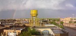
 View from Mayan-e Sofla | |
| 38°04′56″N 46°06′22″E / 38.08222°N 46.10611°E / 38.08222; 46.10611[1] | |
| Country | Iran |
| Province | East Azerbaijan |
| County | Tabriz |
| District | Central |
| Rural District | Aji Chay |
| Area | |
| • Total | 4 km2 (2 sq mi) |
| Population (2016)[2] | |
| • Total | 6,596 |
| • Density | 1,600/km2 (4,300/sq mi) |
| Time zone | UTC+3:30 (IRST) |
| Area code | +9841 |
| |
Mayan-e Sofla (Persian: مايان سفلی)[a] is a village in, and the capital of, Aji Chay Rural District of the Central District of Tabriz County, East Azerbaijan province, Iran.[4]
At the 2006 National Census, its population was 6,399 in 1,236 households.[5] The following census in 2011 counted 7,083 people in 1,694 households.[6] The latest census in 2016 showed a population of 6,596 people in 1,965 households.[2]
Related links
- Mayan-e Sofla in the Persian Wikipedia
- Mayan-e Sofla on the Google Maps
 Iran portal

Notes
References
- ^ OpenStreetMap contributors (26 February 2024). "Mayan-e Sofla, Tabriz County" (Map). OpenStreetMap. Retrieved 26 February 2024.
- ^ a b "Census of the Islamic Republic of Iran, 1395 (2016)". AMAR (in Persian). The Statistical Center of Iran. p. 03. Archived from the original (Excel) on 13 November 2020. Retrieved 19 December 2022.
- ^ Mayan-e Sofla can be found at GEOnet Names Server, at this link, by opening the Advanced Search box, entering "-3074383" in the "Unique Feature Id" form, and clicking on "Search Database".
- ^ Mousavi, Mirhossein (18 May 1366). "Creation and formation of 35 rural districts including villages, farms and places in Tabriz County under East Azerbaijan province". Islamic Parliament Research Center (in Persian). Ministry of Interior, Council of Ministers. Archived from the original on 13 February 2015. Retrieved 5 December 2023.
- ^ "Census of the Islamic Republic of Iran, 1385 (2006)". AMAR (in Persian). The Statistical Center of Iran. p. 03. Archived from the original (Excel) on 20 September 2011. Retrieved 25 September 2022.
- ^ "Census of the Islamic Republic of Iran, 1390 (2011)". Syracuse University (in Persian). The Statistical Center of Iran. p. 03. Archived from the original (Excel) on 16 January 2023. Retrieved 19 December 2022.
- v
- t
- e


and
Sights
- Amir Nezam House
- Arasbaran
- Arg of Tabriz
- Azerbaijan Museum
- Babak Fort
- Bazaar of Tabriz
- Blue Mosque, Tabriz
- Eynali
- Quri-gol
- Haidar Zadeh house
- House of constitution
- Iron Age museum
- Jamee mosque of Tabriz
- Kandovan
- Khodaafarin Bridges
- Maqbaratoshoara
- Maragheh observatory
- Museum of Ostad Bohtouni
- Saint Stepanos Monastery
- Gonbad-e Sorkh
- El-Gölü
- Tabriz Municipality
- Zahhak Castle
- Kiz bridge
| |||||||||||||||||||||||||
|---|---|---|---|---|---|---|---|---|---|---|---|---|---|---|---|---|---|---|---|---|---|---|---|---|---|
| Capital | |||||||||||||||||||||||||
| Districts |
| ||||||||||||||||||||||||
 | This Tabriz County location article is a stub. You can help Wikipedia by expanding it. |
- v
- t
- e


