Manching
Municipality in Bavaria, Germany

Coat of arms
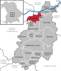
Location of Manching within Pfaffenhofen a.d.Ilm district
(2020–26) Herbert Nerb[1] (FW)
(2022-12-31)[2]
85077
Manching is a municipality in the district of Pfaffenhofen, in Bavaria, Germany. It is situated on the river Paar, 7 km southeast of Ingolstadt. In the late Iron Age, there was a Celtic settlement, the Oppidum of Manching, on the location of present-day Manching.
Airbus Defence and Space (former Military Air Systems business unit of EADS) has its flight test center here at Manching Airport.
The Barthelmarkt, a well-known beer festival in the area, takes place in the district of Oberstimm [de] on the last weekend of August every year.
References
- ^ Liste der ersten Bürgermeister/Oberbürgermeister in kreisangehörigen Gemeinden, Bayerisches Landesamt für Statistik, 15 July 2021.
- ^ Genesis Online-Datenbank des Bayerischen Landesamtes für Statistik Tabelle 12411-003r Fortschreibung des Bevölkerungsstandes: Gemeinden, Stichtag (Einwohnerzahlen auf Grundlage des Zensus 2011) (Hilfe dazu).
- v
- t
- e
Towns and municipalities in Pfaffenhofen (district)

Authority control databases | |
|---|---|
| International |
|
| National |
|
 | This Pfaffenhofen district location article is a stub. You can help Wikipedia by expanding it. |
- v
- t
- e


