Mahvelat County
County in Razavi Khorasan Province, Iran
County in Razavi Khorasan, Iran
Mahvelat County Persian: شهرستان مه ولات | |
|---|---|
County | |
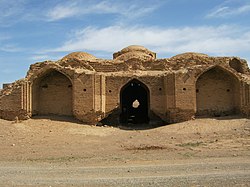 Zarnukh | |
 Location of Mahvelat County in Razavi Khorasan Province (bottom center, green) | |
 Location of Razavi Khorasan Province in Iran | |
| Coordinates: 35°02′N 58°40′E / 35.033°N 58.667°E / 35.033; 58.667[1] | |
| Country | Iran |
| Province | Razavi Khorasan |
| Capital | Feyzabad |
| Districts | Central, Shadmehr |
| Area | |
| • Total | 3,317 km2 (1,281 sq mi) |
| Population (2016)[2] | |
| • Total | 51,409 |
| • Density | 15/km2 (40/sq mi) |
| Time zone | UTC+3:30 (IRST) |
Mahvelat County (Persian: شهرستان مه ولات) is in Razavi Khorasan Province, Iran. Its capital is the city of Feyzabad.[3]
Demographics
Population
At the time of the 2006 National Census, the county's population was 47,068 in 12,268 households.[4] The following census in 2011 counted 48,900 people in 14,226 households.[5] At the 2016 census, the county's population was 51,409 in 15,844 households.[2]
Administrative divisions
Mahvelat County's population history and administrative structure over three consecutive censuses are shown in the following table.
| Administrative Divisions | 2006[4] | 2011[5] | 2016[2] |
|---|---|---|---|
| Central District | 31,211 | 33,488 | 35,656 |
| Howmeh RD | 8,696 | 9,345 | 9,344 |
| Mahvelat-e Jonubi RD | 7,794 | 7,890 | 8,192 |
| Feyzabad (city) | 14,721 | 16,253 | 18,120 |
| Shadmehr District | 15,857 | 15,412 | 15,753 |
| Azghand RD | 11,433 | 7,304 | 7,578 |
| Mahvelat-e Shomali RD | 4,424 | 4,430 | 4,350 |
| Shadmehr (city) | 3,678 | 3,825 | |
| Total | 47,068 | 48,900 | 51,409 |
| RD = Rural District | |||
See also
![]() Media related to Mahvelat County at Wikimedia Commons
Media related to Mahvelat County at Wikimedia Commons
References
- ^ OpenStreetMap contributors (3 May 2023). "Mahvelat County" (Map). OpenStreetMap. Retrieved 3 May 2023.
- ^ a b c "Census of the Islamic Republic of Iran, 1395 (2016)". AMAR (in Persian). The Statistical Center of Iran. p. 09. Archived from the original (Excel) on 2 April 2022. Retrieved 19 December 2022.
- ^ Aref, Mohammad Reza (19 February 1384). "Reforms and changes and divisions in Razavi Khorasan Province". Islamic Parliament Research Center (in Persian). Ministry of Interior, Political-Defense Commission of the Government Board. Archived from the original on 2 September 2014. Retrieved 6 January 2024.
- ^ a b "Census of the Islamic Republic of Iran, 1385 (2006)". AMAR (in Persian). The Statistical Center of Iran. p. 09. Archived from the original (Excel) on 20 September 2011. Retrieved 25 September 2022.
- ^ a b "Census of the Islamic Republic of Iran, 1390 (2011)". Syracuse University (in Persian). The Statistical Center of Iran. p. 09. Archived from the original (Excel) on 20 January 2023. Retrieved 19 December 2022.
- v
- t
- e

- Abbasabad Complex
- Tomb of Abdolabad
- Aliabad Tower
- Amin al-tojar Caravansarai
- Atashgah Manmade-Cave
- Atashgah Castle
- Firuzabad area
- Firuzabad Tower
- Goharshad Mosque
- Haj Soltan Religious School
- Haji Jalal Mosque
- Haruniyeh Dome
- Imam Reza shrine
- Imamzadeh Hamzeh, Kashmar
- Imamzadeh Seyed Morteza
- Jameh Mosque of Kashmar
- Jameh Mosque of Marandiz
- Jameh Mosque of Nishapur
- Jameh Mosque of Sabzevar
- Karat Minaret
- Khosrogerd Minaret
- Kondor Ab anbars
- Kūh-e Tīr Māhī
- Mausoleum of Attar of Nishapur
- Mausoleum of Omar Khayyám
- Khalilabad Hot Spring
- Pamenar Mosque, Sabzevar
- Qanats of Ghasabeh
- Ribat of Kabudan
- Ribat of Sharaf
- Rig castle
- Shahi Dam
- Sheikh Ahmad-e Jami mausoleum complex
- Seyyed Bagher Ab anbar
- Shadiyakh
- Sir Cave
- Tandooreh National Park
- Tomb of Baba Loghman
- Tomb of Boghrat
- Tomb of Ferdowsi
- Tomb of Hadi Sabzevari
- Tomb of Hassan Modarres
- Tomb of Heydar Yaghma
- Tomb of Kamal-ol-molk
- Tomb of Khajeh Rabie
- Tomb of Nader Shah
- Qal'eh Dokhtar, Kuhsorkh
 Mahvelat County Mahvelat County | |||||||||||||||||||||
|---|---|---|---|---|---|---|---|---|---|---|---|---|---|---|---|---|---|---|---|---|---|
| Capital | |||||||||||||||||||||
| Districts |
| ||||||||||||||||||||
 | This Razavi Khorasan province location article is a stub. You can help Wikipedia by expanding it. |
- v
- t
- e


