Libyan Sea
Portion of the Mediterranean Sea north of the African coast of ancient Libya


The Libyan Sea (Latin: Libycum Mare; Arabic: البحر الليبي; Greek: Λιβυκό πέλαγος) is the portion of the Mediterranean Sea north of the African coast of ancient Libya, i.e. Cyrenaica, and Marmarica (the coast of what is now eastern Libya and western Egypt, between Tobruk and Alexandria).[1] This designation was used by ancient geographers describing the southern Mediterranean, but the term is also used by modern travel writers and cartographers.[2]
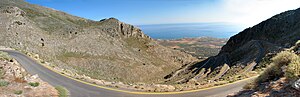
The southern coastline of Crete which borders the Libyan Sea includes the Asterousia Mountains and Mesara Plain; this area is the locus of considerable ancient Bronze Age settlement including the sites of Kommos, Hagia Triada and Phaistos.[3]
Not counting Crete, other islands in the Libyan Sea are Gavdos, Gavdopoula, Koufonisi, and Chrysi.
To the east is the Levantine Sea, to the north the Ionian Sea, and to the west the Strait of Sicily.
See also
References
- v
- t
- e
Marginal seas of the Atlantic Ocean
- Adriatic Sea
- Aegean Sea
- Alboran Sea
- American Mediterranean Sea
- Archipelago Sea
- Argentine Sea
- Balearic Sea
- Baltic Sea
- Black Sea
- Bothnian Sea
- Caribbean Sea
- Celtic Sea
- Greenland Sea
- Icarian Sea
- Ionian Sea
- Irish Sea
- Irminger Sea
- Labrador Sea
- Levantine Sea
- Libyan Sea
- Ligurian Sea
- Marmara Sea
- Mediterranean Sea
- Myrtoan Sea
- North Sea
- Norwegian Sea
- Sargasso Sea
- Sea of Åland
- Sea of Azov
- Sea of Crete
- Sea of the Hebrides
- Thracian Sea
- Tyrrhenian Sea
- Wadden Sea
 Oceans portal
34°00′N 24°24′E / 34.000°N 24.400°E / 34.000; 24.400
 | This Libya location article is a stub. You can help Wikipedia by expanding it. |
- v
- t
- e
 | This Greece location article is a stub. You can help Wikipedia by expanding it. |
- v
- t
- e


