Lernapat
40°49′12″N 44°23′50″E / 40.82000°N 44.39722°E / 40.82000; 44.39722
Place in Lori Province, Armenia
Lernapat Լեռնապատ | |
|---|---|
 | |
  Lernapat | |
| Coordinates: 40°49′12″N 44°23′50″E / 40.82000°N 44.39722°E / 40.82000; 44.39722 | |
| Country | Armenia |
| Marz (Province) | Lori Province |
| Population (2008) | |
| • Total | 1,857 |
| Time zone | UTC+4 ( ) |
Lernapat (Armenian: Լեռնապատ, also romanized as Lerrnapat; formerly, Makarashen and Gadzhikara) is a village in the Lori Province of Armenia. It is located around 5 kilometres north-west of the Vanadzor.
Demographics
| Year | Pop. | ±% p.a. | |
|---|---|---|---|
| 1831 | 143 | — | |
| 1897 | 1,253 | +3.34% | |
| 1926 | 1,457 | +0.52% | |
| 1939 | 1,680 | +1.10% | |
| 1959 | 1,462 | −0.69% | |
| 1970 | 1,748 | +1.64% | |
| 1979 | 1,727 | −0.13% | |
| 2001 | 2,030 | +0.74% | |
| 2004 | 1,789 | −4.13% | |
| |||
| Source: [1] | |||
-
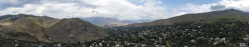 A panorama of Lernapat village, Armenia.

Gallery
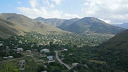
- Lernapat village from above
-
 Saint Nshan chapel (before April 2014)
 -
 Lernapat church (19th century)
 -
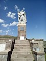 Monument to those who fell in the 1941-1945 Great Patriotic War
 -
 Gabriel-Munkel height and Saint Gabriel chapel


References
- ^ Հայաստանի Հանրապետության բնակավայրերի բառարան [Republic of Armenia settlements dictionary] (PDF) (in Armenian). Yerevan: Cadastre Committee of the Republic of Armenia. 2008. Archived from the original (PDF) on 11 March 2018.
External links
- Lernapat at GEOnet Names Server
- World Gazeteer: Armenia[dead link] – World-Gazetteer.com
- Report of the results of the 2001 Armenian Census, Statistical Committee of Armenia
- v
- t
- e
 Lori Province
Capital: Vanadzor

- Akhtala (village)
- Aroghjaranin kits
- Bendik
- Chochkan
- Mets Ayrum
- Neghots
- Pokr Ayrum
 | This article about a location in Lori Province, Armenia is a stub. You can help Wikipedia by expanding it. |
- v
- t
- e


