Kalininaul, Kazbekovsky District, Republic of Dagestan
Selo in Dagestan, Russia
Kalininaul Калининаул | |
|---|---|
Selo[1] | |
| Other transcription(s) | |
| • Avar | Калининаул |
| • Chechen | Ширча-Ӏовх, Ширча-Эвла, Şirça-Evla |
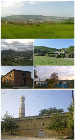 Views of Kalininaul | |
Location of Kalininaul  | |
43°04′15″N 46°34′02″E / 43.07083°N 46.56722°E / 43.07083; 46.56722 | |
| Country | Russia |
| Federal subject | Dagestan[1] |
| Administrative district | Kazbekovsky District[1] |
| Population (2010 Census)[1] | |
| • Total | 4,531 |
| Time zone | UTC+3 (MSK |
| Postal code(s)[3] | 368157 |
| OKTMO ID | 82622440101 |
Kalininaul Until 1944 Yurt-Aukh[4] (Russian: Калининаул, Until 1944 Russian: Юрт-Аух; Chechen: Ширча-Ӏовх[5][6]) is a rural locality (a selo) in Kazbekovsky District of the Republic of Dagestan, Russia, located on the right bank of the Aktas River, at the confluence with the Sala-su River, opposite the selo of Leninaul, 18 kilometers (11 mi) south of Khasavyurt on the border with the Chechen Republic. Population: 4,531 (2010 Russian census);[1] 4,439 (2002 Census);[7] predominantly Chechen.
History
The oldest village of Chechens in the Terco-Sulak Meternrech. It was previously known as Shircha-Evla, Yurt-Evla, and Yurt-Aukh.
Yurt-Aukh, as it was then called, was until 1944 a part of the Aukh District. In 1944, during the deportation of Chechens to Central Asia, the locals were deported and Avars from the neighboring selo of Almak settled in their place.
In 1956, the Chechens were allowed to return to the Caucasus, but the local authorities prohibited their return directly to their ancestral villages in former Aukh District. Only several years later the Chechens were able to start buying back their houses from the Avars.
On August 27, 2007, a clash between over one hundred Chechens and Avars took place in Kalininaul, resulting in eight people injured.
Infrastructure
An elementary and a secondary school operate in Kalininaul. There is also a House of Culture, a post office, a kindergarten, and four mosques (two Chechen and two Avar).
Teips
The village is inhabited by the following chechen teips (clans):[citation needed]
- Akkoy
- Pharchhoy
- Bittroy
- Chenti
- Chontoy
- Shinroy
- Nokkhoy
- Vyappy
References
- ^ a b c d e f Russian Federal State Statistics Service (2011). Всероссийская перепись населения 2010 года. Том 1 [2010 All-Russian Population Census, vol. 1]. Всероссийская перепись населения 2010 года [2010 All-Russia Population Census] (in Russian). Federal State Statistics Service.
- ^ "Об исчислении времени". Официальный интернет-портал правовой информации (in Russian). June 3, 2011. Retrieved January 19, 2019.
- ^ Почта России. Информационно-вычислительный центр ОАСУ РПО. (Russian Post). Поиск объектов почтовой связи (Postal Objects Search) (in Russian)
- ^ 1941 American Caucasus Map of 1941
- ^ Ахмадов 2009, p. 188.
- ^ Мусаев З. М. Чеченский тайп аккой — 2017. — 17 ноября.
- ^ Federal State Statistics Service (May 21, 2004). Численность населения России, субъектов Российской Федерации в составе федеральных округов, районов, городских поселений, сельских населённых пунктов – районных центров и сельских населённых пунктов с населением 3 тысячи и более человек [Population of Russia, Its Federal Districts, Federal Subjects, Districts, Urban Localities, Rural Localities—Administrative Centers, and Rural Localities with Population of Over 3,000] (XLS). Всероссийская перепись населения 2002 года [All-Russia Population Census of 2002] (in Russian).
Literature
- Ахмадов, Я. З. (2009). Очерк исторической географии и этнополитического развития Чечни в XVI-XVIII веках. Москва. ISBN 978-5-91821-013-0.
{{cite book}}: CS1 maint: location missing publisher (link)
- v
- t
- e


