João Neiva
Municipality in Southeast, Brazil

Flag

Seal

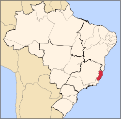
Location in the State of Espírito Santo
 Brazil
 Espírito Santo
 (2020 [1])
29680-000
19°45′28″S 40°23′09″W / 19.75778°S 40.38583°W / -19.75778; -40.38583
João Neiva is a municipality located in the Brazilian state of Espírito Santo. Its population was 16,722 (2020) and its area is 273 km².[2]
References
- v
- t
- e
Capital: Vitória
| Afonso Cláudio |
|
|---|---|
| Guarapari | |
| Santa Teresa | |
| Vitória |

| Linhares | |
|---|---|
| Montanha | |
| São Mateus |
| Barra de São Francisco | |
|---|---|
| Colatina | |
| Nova Venécia |
| Alegre | |
|---|---|
| Cachoeiro de Itapemirim | |
| Itapemirim |
| Authority control databases |
|
|---|
 | This geographical article relating to Espírito Santo is a stub. You can help Wikipedia by expanding it. |
- v
- t
- e


