Iguatu
Municipality in Northeast, Brazil

Flag

Coat of arms

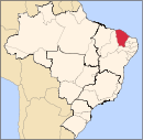
Location in Ceará state
(2020 est.[1])
Iguatu is a city in Ceará, a Brazilian State, with a population of 103,074 (2020 est.). Edinaldo Lavor is the city's mayor.
History
A village of Quixelôs Indians existed at this site before the arrival of the Portuguese. In 1707 the Society of Jesus began Western settlement here. It has been classed as a city since 1874. It is the seat of the Roman Catholic Diocese of Iguatu.
Transportation
Iguatu is served by Dr. Francisco Tomé da Frota Airport.
Notable people
- Eleazar de Carvalho - Conductor and composer.
- Humberto Teixeira - composer.
Climate
| Climate data for Iguatu (1981–2010) | |||||||||||||
|---|---|---|---|---|---|---|---|---|---|---|---|---|---|
| Month | Jan | Feb | Mar | Apr | May | Jun | Jul | Aug | Sep | Oct | Nov | Dec | Year |
| Mean daily maximum °C (°F) | 33.4 (92.1) | 32.3 (90.1) | 31.8 (89.2) | 31.1 (88.0) | 31.2 (88.2) | 31.5 (88.7) | 32.4 (90.3) | 33.5 (92.3) | 35.0 (95.0) | 35.7 (96.3) | 35.7 (96.3) | 35.1 (95.2) | 33.2 (91.8) |
| Daily mean °C (°F) | 27.6 (81.7) | 26.8 (80.2) | 26.6 (79.9) | 26.2 (79.2) | 25.9 (78.6) | 25.5 (77.9) | 26.1 (79.0) | 27.1 (80.8) | 28.3 (82.9) | 29.3 (84.7) | 29.5 (85.1) | 29.2 (84.6) | 27.3 (81.1) |
| Mean daily minimum °C (°F) | 23.1 (73.6) | 22.6 (72.7) | 22.5 (72.5) | 22.3 (72.1) | 21.7 (71.1) | 20.6 (69.1) | 20.7 (69.3) | 21.3 (70.3) | 22.3 (72.1) | 23.1 (73.6) | 23.5 (74.3) | 23.6 (74.5) | 22.3 (72.1) |
| Average precipitation mm (inches) | 133.8 (5.27) | 167.3 (6.59) | 221.2 (8.71) | 196.8 (7.75) | 102.7 (4.04) | 27.6 (1.09) | 12.6 (0.50) | 14.4 (0.57) | 12.3 (0.48) | 19.0 (0.75) | 7.9 (0.31) | 67.5 (2.66) | 983.1 (38.70) |
| Average precipitation days (≥ 1.0 mm) | 10 | 11 | 14 | 14 | 8 | 4 | 3 | 2 | 2 | 1 | 1 | 4 | 74 |
| Average relative humidity (%) | 66.3 | 73.5 | 77.5 | 80.9 | 77.6 | 68.4 | 58.9 | 49.8 | 46.9 | 46.8 | 47.1 | 51.3 | 62.1 |
| Mean monthly sunshine hours | 216.0 | 196.3 | 217.4 | 216.4 | 236.8 | 251.3 | 268.4 | 293.2 | 293.2 | 292.0 | 275.5 | 252.8 | 3,009.3 |
| Source: Instituto Nacional de Meteorologia[2] | |||||||||||||
References
External links
- Iguatu governmental site (In Portuguese)
- v
- t
- e

Capital: Fortaleza
Centro-Sul Cearense | |||||||
|---|---|---|---|---|---|---|---|
| |||||||
Jaguaribe | |||||||||
|---|---|---|---|---|---|---|---|---|---|
| |||||||||
Metropolitana de Fortaleza | |||||
|---|---|---|---|---|---|
| |||||
Noroeste Cearense | |||||||||||||||
|---|---|---|---|---|---|---|---|---|---|---|---|---|---|---|---|
| |||||||||||||||
Norte Cearense | |||||||||||||||||
|---|---|---|---|---|---|---|---|---|---|---|---|---|---|---|---|---|---|
| |||||||||||||||||
Sertoes Cearenses | |||||||||
|---|---|---|---|---|---|---|---|---|---|
| |||||||||
Sul Cearense | |||||||||||
|---|---|---|---|---|---|---|---|---|---|---|---|
| |||||||||||
| Authority control databases: Geographic |
|
|---|
 | This Ceará, Brazil location article is a stub. You can help Wikipedia by expanding it. |
- v
- t
- e


