Heerde
Municipality in Gelderland, Netherlands

Flag

Coat of arms

Location in Gelderland
(January 2021)[3]
8180–8194
Heerde (Dutch pronunciation: [ˈɦeːrdə] ⓘ) is a municipality and a town in the province of Gelderland, in the eastern Netherlands. Compared to the rest of the Netherlands, Heerde is fairly religious, as are many of the towns and cities in the Veluwe region.
Population centres
Politics
The Heerde municipal council consists of 17 seats, which since the 2022 municipal elections have been divided as follows:[4]
- CDA - 4 seats
- Municipal Interest Farmers Party, Heerde - 4 seats
- CU-SGP - 3 seats
- VVD - 2 seats
- D66-GL - 2 seats
- PvdA - 2 seats
Sport
The municipality has five amateur soccer clubs: vv Heerde,[5] SEH, WZC Wapenveld, vv Wapenveld and Vevo.
Topography

Map of the municipality of Heerde, June 2015.
Notable residents

- Daniël de Clercq (1854 in Heerde – 1931) a Dutch socialist and activist
- Hendrik Jan van Duren (1937 in Heerde – 2008) a Dutch politician.
- Marijke Abels (born 1948 in Deventer) a Dutch visual artist, one of her sculptures is at the roundabout of the A50 junction in Heerde
Sport
- Jaap Zielhuis (born 1966 in Heerde) a Dutch sailor, competed at the 2004 Summer Olympics
- Jacco Eltingh (born 1970 in Heerde) a former professional tennis player
- Gerard van Velde (born 1971 in Wapenveld) a Dutch retired speed skating sprinter, gold medallist in the 2002 Winter Olympics
Gallery
-
 Heerde - Huis Vosbergen - sundial
 -
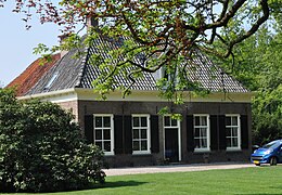 Heerde, Farm at Boerderij Vosbergerweg
 -
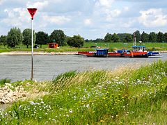 Wijhese ferry over the IJssel
 -
 Apeldoorn Canal: view at Bonenbergerbrug - Heerde


References
- ^ "Kerncijfers wijken en buurten 2020" [Key figures for neighbourhoods 2020]. StatLine (in Dutch). CBS. 24 July 2020. Retrieved 19 September 2020.
- ^ "Postcodetool for 8181JE". Actueel Hoogtebestand Nederland (in Dutch). Het Waterschapshuis. Archived from the original on 21 September 2013. Retrieved 7 July 2014.
- ^ "Bevolkingsontwikkeling; regio per maand" [Population growth; regions per month]. CBS Statline (in Dutch). CBS. 1 January 2021. Retrieved 2 January 2022.
- ^ "Heerde municipal election 2022". verkiezingsuitslagen.nl (in Dutch). 16 March 2022. Retrieved 21 April 2024.
- ^ "Nieuws". Archived from the original on 2007-01-01. Retrieved 2007-01-12.
External links
 Media related to Heerde at Wikimedia Commons
- Official website


- v
- t
- e
- Aalten
- Apeldoorn
- Arnhem
- Barneveld
- Berg en Dal
- Berkelland
- Beuningen
- Bronckhorst
- Brummen
- Buren
- Culemborg
- Doesburg
- Doetinchem
- Druten
- Duiven
- Ede
- Elburg
- Epe
- Ermelo
- Harderwijk
- Hattem
- Heerde
- Heumen
- Lingewaard
- Lochem
- Maasdriel
- Montferland
- Neder-Betuwe
- Nijkerk
- Nijmegen
- Nunspeet
- Oldebroek
- Oost Gelre
- Oude IJsselstreek
- Overbetuwe
- Putten
- Renkum
- Rheden
- Rozendaal
- Scherpenzeel
- Tiel
- Voorst
- Wageningen
- West Betuwe
- West Maas en Waal
- Westervoort
- Wijchen
- Winterswijk
- Zaltbommel
- Zevenaar
- Zutphen

- See also
- Netherlands
- Provinces
- Municipalities
Authority control databases | |
|---|---|
| International |
|
| National |
|
| Geographic |
|
 | This Gelderland location article is a stub. You can help Wikipedia by expanding it. |
- v
- t
- e


