Haeju Airport
Airport in South Hwanghae, North Korea


Haeju

Haeju
Haeju
Haeju
| Direction | Length | Surface | |
|---|---|---|---|
| m | ft | ||
| 12/30 | 2,000 | 6,562 | Grass |
| Haeju Airport | |
| Chosŏn'gŭl | 해주비행장 |
|---|---|
| Hancha | 海州飛行場 |
| Revised Romanization | Haeju Bihaengjang |
| McCune–Reischauer | Haeju Bihaengjang |
Haeju Airport is an airport located in Haeju, South Hwanghae, North Korea. Haeju Airport is controlled by the Korean People's Army. The airport mainly operates military flights but also has a limited number of civilian flights. This airport is notorious to South Korean intelligence authorities, because former North Korean Intelligence agents frequently use it as a transfer point [citation needed]. The single runway 12/30 is 6562x289 ft (2000x88 m).
History
In the period from June 1946 to November 1948 it was used as a base for parts of the 250th Fighter Division.[1] During the Korean War, the US Army designated as K-19. During the Korean War the USAF designated the airfield as K-19.
References
- ^ Анохин В. А., Быков М. Ю. Все истребительные авиаполки Сталина. Первая полная энциклопедия. — Научно-популярное издание. — М.: Яуза-пресс, 2014. — 944 с. — 1500 экз. — ISBN 978-5-9955-0707-9
- v
- t
- e
- Pyongyang International Airport
- Haeju
- Kalma
- Orang
- Samjiyon
- Sondok
- Changjin
- Chiktong
- Chodo
- Hoeyang Southeast
- Hwangju
- Hwangsuwon
- Hyesan
- Hyon Ni
- Ichon
- Ichon Northeast
- Kaechon
- Kang Da Ri
- Kangdong
- Koksan
- Kuktong
- Kumgang
- Kuum Ni
- Kwail
- Kwaksan
- Kyongsong Chuul
- Maengsan
- Manpo
- Mirim
- Onchon
- Ongjin
- Paegam
- Panghyon
- Pukchang
- Pyongsul Li
- Rihyon
- Riwon
- Sinuiju
- Sohung
- Sonchon
- Sunchon
- Sungam
- Taebukpo
- Taechon
- Taechon Northwest
- Taetan
- Tanchon South
- Toha Ri North
- Toksan
- Uiju
- Unchon Up
- Yonpo
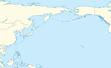
38°00′20″N 125°46′43″E / 38.005430°N 125.778630°E / 38.005430; 125.778630
 | This article about an airport in North Korea is a stub. You can help Wikipedia by expanding it. |
- v
- t
- e
 | This article about the Korean War is a stub. You can help Wikipedia by expanding it. |
- v
- t
- e


