Hương Sơn district
You can help expand this article with text translated from the corresponding article in Vietnamese. (March 2009) Click [show] for important translation instructions.
- View a machine-translated version of the Vietnamese article.
- Machine translation, like DeepL or Google Translate, is a useful starting point for translations, but translators must revise errors as necessary and confirm that the translation is accurate, rather than simply copy-pasting machine-translated text into the English Wikipedia.
- Consider adding a topic to this template: there are already 953 articles in the main category, and specifying
|topic=will aid in categorization. - Do not translate text that appears unreliable or low-quality. If possible, verify the text with references provided in the foreign-language article.
- You must provide copyright attribution in the edit summary accompanying your translation by providing an interlanguage link to the source of your translation. A model attribution edit summary is
Content in this edit is translated from the existing Vietnamese Wikipedia article at [[:vi:Hương Sơn]]; see its history for attribution. - You may also add the template
{{Translated|vi|Hương Sơn}}to the talk page. - For more guidance, see Wikipedia:Translation.
District in North Central Coast, Vietnam
Hương Sơn district Huyện Hương Sơn | |
|---|---|
 View of National Route 8 | |
 Seal | |
 | |
| Country |  Vietnam Vietnam |
| Region | North Central Coast |
| Province | Hà Tĩnh |
| Founded | 1469 |
| Capital | Phố Châu |
| Government | |
| • Chairman of the People's Committee | Lê Minh Khuê |
| • Chairman of the People's Council | Hà Nội |
| • Chairman of the Fatherland Front | Nguyễn Ngọc Anh |
| Area | |
| • Total | 366.9 sq mi (950.2 km2) |
| Population (2003) | |
| • Total | 125,308 |
| Time zone | UTC+7 (Indochina Time) |
| Website | huongson |
Hương Sơn is a district in the North Central Coast of Vietnam. It is part of Hà Tĩnh province. In 2003, the district had a population of 125,308.[1] The district covers an area of 1101 km2. The district capital lies at Phố Châu.[1]
Geography
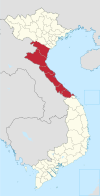
Hà Tĩnh Province is located in the northern part of central Vietnam, about 340 km south of Hanoi, bordered by Nghệ An province in the north, Quảng Bình province in the south, Laos in the west, and Đức Thọ district in the east.
Administration
The district consists of 2 towns, Phố Châu (also the district capital) and Tây Sơn, and 23 communes: An Hòa Thịnh, Kim Hoa, Quang Diệm, Sơn Bằng, Sơn Bình, Sơn Châu, Sơn Giang, Sơn Hàm, Sơn Hồng, Sơn Kim 1, Sơn Kim 2, Sơn Lâm, Sơn Lễ, Sơn Lĩnh, Sơn Long, Sơn Ninh, Sơn Phú, Sơn Tây, Sơn Tiến, Sơn Trà, Sơn Trung, Sơn Trường and Tân Mỹ Hà.
References
- ^ a b "Districts of Vietnam". Statoids. Retrieved March 20, 2009.
External links
18°25′01″N 106°25′01″E / 18.417°N 106.417°E / 18.417; 106.417
- v
- t
- e
Districts of Vietnam North Central Coast
- Đồng Hới city※
- Ba Đồn town
- Bố Trạch
- Lệ Thủy
- Minh Hóa
- Quảng Ninh
- Quảng Trạch
- Tuyên Hóa
- Huế city※
- Hương Thủy town
- Hương Trà town
- A Lưới
- Nam Đông
- Phong Điền
- Phú Lộc
- Phú Vang
- Quảng Điền
※ denotes provincial seat.
 | This article about a location in Hà Tĩnh Province, Vietnam is a stub. You can help Wikipedia by expanding it. |
- v
- t
- e


