Guldara
Place in Kabul Province, Afghanistan
34°49′1″N 69°5′16″E / 34.81694°N 69.08778°E / 34.81694; 69.08778 Afghanistan
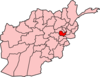
Guldara (also Gūḏāra, Gudara, or Gowdārah) is a village and the center of Guldara District, Kabul Province, Afghanistan.[1] It is located at 34°49′02″N 69°05′16″E / 34.8172°N 69.0878°E / 34.8172; 69.0878 at 1722 m altitude, 45 km North of Kabul. The village was almost fully destroyed and now is continuing the process of rehabilitation. A new clinic has been opened. A local NGO, Afghan Educational and Rehabilitation Organisation (AERO) is running this clinic which will provide family planning, child and general health services to a population of around 38,000 people.
See also
- Kabul Province
References
- ^ "Guldara". GEOnet Names Server. Retrieved 3 October 2019.
- v
- t
- e
Kabul Province
Capital: Kabul
- Bagrami
- Char Asiab
- Deh Sabz
- Farza
- Guldara
- Istalif
- Kabul
- Kalakan
- Khaki Jabbar
- Mir Bacha Kot
- Mussahi
- Paghman
- Qarabagh
- Shakardara
- Surobi
- Presidential Palace
- Darul Aman Palace
- Bagh-e Bala Palace
- Tajbeg Palace
- Chihil Sutun Palace
- Paghman Hill Castle
- Taq-e Zafar
- Bala Hissar
- Gardens of Babur
- InterContinental Hotel
- Safi Landmark Hotel
- Kabul City Center
- Kabul Serena Hotel
- Kabul's Irish Pub
- Kabul Library
- National Museum of Afghanistan
- Abdul Rahman Mosque
- Pul-e Khishti Mosque
- Id Gah Mosque
- Shah-Do Shamshira Mosque
- Gurdwara Karte Parwan
| Authority control databases |
|
|---|
 | This Kabul Province, Afghanistan location article is a stub. You can help Wikipedia by expanding it. |
- v
- t
- e


