Guanghe County
County in Gansu, China
Guanghe County 广河县 · ﻗُﻮْا حْ ﺷِﯿًﺎْ | |
|---|---|
County | |
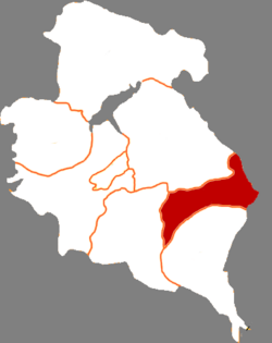 Guanghe in Linxia | |
 Linxia in Gansu | |
35°29′17″N 103°34′33″E / 35.4881°N 103.5758°E / 35.4881; 103.5758 | |
| Country | China |
| Province | Gansu |
| Autonomous prefecture | Linxia |
| County seat | Chengguan |
| Area | |
| • Total | 538 km2 (208 sq mi) |
| Population (2020)[1] | |
| • Total | 260,596 |
| • Density | 480/km2 (1,300/sq mi) |
| Time zone | UTC+8 (China Standard) |
| Postal code | 731300 |
| Website | www |
| Part of a series on Islam in China |
|---|
 |
| Culture
|
 Islam portal • Islam portal •  China portal China portal |
|
Guanghe County (simplified Chinese: 广河县; traditional Chinese: 廣河縣; pinyin: Guǎnghé Xiàn; Wade–Giles: Kuang-ho Hsien, Xiao'erjing: ﻗُﻮْا حْ ﺷِﯿًﺎْ) is a county in the Linxia Hui Autonomous Prefecture, located in the province of Gansu of the People's Republic of China. It contains an ethnic minority of the Dongxiang.
Administrative divisions
Guanghe County is divided to 6 towns 2 townships and 1 ethnic township.[2]
- Towns
|
|
- Townships
- Shuiquan Township(水泉乡)
- Guanfang Township(官坊乡)
- 1 Ethnic township
- Alimatu Dongxiang Township(阿力麻土东乡族乡)
Climate
| Climate data for Guanghe (1991–2020 normals, extremes 1981–2010) | |||||||||||||
|---|---|---|---|---|---|---|---|---|---|---|---|---|---|
| Month | Jan | Feb | Mar | Apr | May | Jun | Jul | Aug | Sep | Oct | Nov | Dec | Year |
| Record high °C (°F) | 13.6 (56.5) | 20.7 (69.3) | 26.7 (80.1) | 30.3 (86.5) | 31.3 (88.3) | 31.5 (88.7) | 36.2 (97.2) | 33.7 (92.7) | 31.0 (87.8) | 24.6 (76.3) | 19.0 (66.2) | 11.6 (52.9) | 36.2 (97.2) |
| Mean daily maximum °C (°F) | 1.2 (34.2) | 5.4 (41.7) | 11.3 (52.3) | 17.5 (63.5) | 21.2 (70.2) | 24.2 (75.6) | 26.0 (78.8) | 24.9 (76.8) | 20.0 (68.0) | 14.6 (58.3) | 8.6 (47.5) | 2.6 (36.7) | 14.8 (58.6) |
| Daily mean °C (°F) | −6.7 (19.9) | −2.2 (28.0) | 3.8 (38.8) | 9.7 (49.5) | 13.7 (56.7) | 17.0 (62.6) | 18.6 (65.5) | 17.7 (63.9) | 13.2 (55.8) | 7.4 (45.3) | 0.8 (33.4) | −5.2 (22.6) | 7.3 (45.2) |
| Mean daily minimum °C (°F) | −12.0 (10.4) | −7.5 (18.5) | −1.8 (28.8) | 3.2 (37.8) | 7.4 (45.3) | 10.9 (51.6) | 12.7 (54.9) | 12.3 (54.1) | 8.6 (47.5) | 2.6 (36.7) | −4.0 (24.8) | −10.2 (13.6) | 1.9 (35.3) |
| Record low °C (°F) | −24.0 (−11.2) | −21.2 (−6.2) | −16.2 (2.8) | −7.4 (18.7) | −3.7 (25.3) | 3.0 (37.4) | 4.4 (39.9) | 4.7 (40.5) | −0.4 (31.3) | −8.9 (16.0) | −18.2 (−0.8) | −26.7 (−16.1) | −26.7 (−16.1) |
| Average precipitation mm (inches) | 3.9 (0.15) | 5.2 (0.20) | 12.3 (0.48) | 28.6 (1.13) | 59.6 (2.35) | 59.0 (2.32) | 97.1 (3.82) | 96.1 (3.78) | 66.3 (2.61) | 35.4 (1.39) | 6.2 (0.24) | 1.6 (0.06) | 471.3 (18.53) |
| Average precipitation days (≥ 0.1 mm) | 4.4 | 4.7 | 6.6 | 8.1 | 11.6 | 12.8 | 14.0 | 13.4 | 13.2 | 10.1 | 3.9 | 2.3 | 105.1 |
| Average snowy days | 6.8 | 7.4 | 7.5 | 2.5 | 0.3 | 0 | 0 | 0 | 0 | 1.6 | 4.5 | 4.6 | 35.2 |
| Average relative humidity (%) | 63 | 61 | 58 | 55 | 61 | 67 | 74 | 77 | 81 | 79 | 72 | 65 | 68 |
| Mean monthly sunshine hours | 187.9 | 185.5 | 211.8 | 227.4 | 239.3 | 233.5 | 241.2 | 224.5 | 167.2 | 175.6 | 187.7 | 195.2 | 2,476.8 |
| Percent possible sunshine | 60 | 60 | 57 | 58 | 55 | 54 | 55 | 54 | 46 | 51 | 62 | 65 | 56 |
| Source: China Meteorological Administration[3][4] | |||||||||||||
Sources
- ^ "临夏州第七次全国人口普查公报" (in Chinese). Government of Linxia Prefecture. 2021-06-08.
- ^ "统计用区划代码 www.stats.gov.cn" (in Chinese). XZQH. Retrieved 2012-05-26.
- ^ 中国气象数据网 – WeatherBk Data (in Simplified Chinese). China Meteorological Administration. Retrieved 27 August 2023.
- ^ 中国气象数据网 (in Simplified Chinese). China Meteorological Administration. Retrieved 27 August 2023.
 | This Gansu location article is a stub. You can help Wikipedia by expanding it. |
- v
- t
- e


