Gmina Bierawa
Gmina in Opole Voivodeship, Poland
Gmina Bierawa Gemeinde Birawa Bierawa Commune | |
|---|---|
Gmina | |
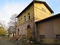
 Houses in Kotlarnia | |
 Flag  Coat of arms | |
| Coordinates (Bierawa): 50°17′9″N 18°14′32″E / 50.28583°N 18.24222°E / 50.28583; 18.24222 | |
| Country |  Poland Poland |
| Voivodeship | Opole |
| County | Kędzierzyn-Koźle |
| Seat | Bierawa |
| Area | |
| • Total | 119.24 km2 (46.04 sq mi) |
| Population (2019-06-30[1]) | |
| • Total | 7,910 |
| • Density | 66/km2 (170/sq mi) |
| Website | http://www.bierawa.pl/ |
Gmina Bierawa, German Gemeinde Birawa is a rural gmina (administrative district) in Kędzierzyn-Koźle County, Opole Voivodeship, in south-western Poland. Its seat is the village of Bierawa, which lies approximately 8 kilometres (5 mi) south-east of Kędzierzyn-Koźle and 48 km (30 mi) south-east of the regional capital Opole.
The gmina covers an area of 119.24 square kilometres (46.0 sq mi), and as of 2019 its total population is 7,910. Since 2007 the commune, like much of the area, is officially bilingual in German and Polish.
Administrative divisions
The commune contains the villages and settlements of:
- Bierawa
- Brzeźce
- Dziergowice
- Goszyce
- Grabówka
- Korzonek
- Kotlarnia
- Lubieszów
- Ortowice
- Solarnia
- Stara Kuźnia
- Stare Koźle
Neighbouring gminas
Gmina Bierawa is bordered by the gminas of Kuźnia Raciborska, Rudziniec, Sośnicowice and Toszek.
Twin towns – sister cities
Gmina Bierawa is twinned with:[2]
 Ostfildern, Germany

Gallery
-
 Dziergowice train station
 -
 Street in Brzeźce
 -
 Bierawa train station


References
- ^ "Population. Size and structure and vital statistics in Poland by territorial division in 2019. As of 30th June". stat.gov.pl. Statistics Poland. 2019-10-15. Retrieved 2020-02-14.
- ^ "Partnerstwo i przynależność do związków i stowarzyszeń". bierawa.pl (in Polish). Gmina Bierawa. Retrieved 2020-03-04.
Wikimedia Commons has media related to Gmina Bierawa.
- v
- t
- e
Gmina Bierawa

| ||
|---|---|---|
| Urban gminas |
|  |
| Rural gminas |
| |


