Fra Cristobal Range


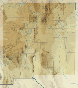
The Fra Cristobal Range, (Fra Cristóbal Range) is a 17 mi (27 km) long, mountain range in central-north Sierra County, New Mexico. Its northern extreme above Fra Cristoblal Mountain extends into Socorro County. The range borders the eastern shore of Elephant Butte Reservoir on the Rio Grande, and the range lies towards the southwest of the Jornada del Muerto, the desert region east of the river.[1]
Description
The Fra Cristobal Range is an arid, moderate elevation, north–south trending mountain range, about 17 mi long and narrow, only about 7 mi at its widest. Crater Hill, 5,087 feet (1,551 m) lies west of the central ridgeline, and north of Black Bluffs, Red Cliff at the Reservoir.[1]
The high peak in the northern end of the range, which gives the range its name, is Fra Cristobal Mountain, 5,932 feet (1,808 m), is at the north perimeter of the range. It is located at 33°28′12″N 107°05′55″W / 33.47000°N 107.09861°W / 33.47000; -107.09861 (Fra Cristobal Mountain)[2] The mountain is said to have resembled the profile of a priest, Fray Cristóbal de Salazar, a cousin of Juan de Oñate, with the first colonizing expedition in 1598.[3]: 157, note 21
References
External links
Range Highpoint
- Fra Cristobal Mountain, mountainzone, (coordinates), (elev: 5955)
Fra Cristobal Range
- Crater Hill, (approximate range center (at west)), mountainzone, coordinates
- Fra Cristobal Range, mountainzone
- v
- t
- e
- Black Mountain (Catron County)
- McKnight Mountain
- Cerro Grande
- Chicoma Mountain
- Redondo Peak
- South Baldy
- Pyramid Peak
(Cibola County)
- Mount Taylor
- West Blue Mountain
| Manzano Mountains | |
|---|---|
| Sandia Mountains |
| Cimarron Range |
|
|---|---|
| Taos Mountains |
|
| Others |
|
- Haystack Mountain
- Mount Sedgwick
- Aden Crater
- Alamo Hueco Mountains
- Animas Mountains
- Brazos Mountains
- Caballo Mountains
- Canjilón Mountain
- Canyon Creek Mountains
- Capitan Mountains
- Capulin Peak
- Cedar Mountain Range
- Datil Mountains
- Dirty Point
- Doña Ana Mountains
- Eagle Peak
- East Potrillo Mountains
- Elephant Butte (Hidalgo County)
- Elephant Butte (Sierra County)
- Fajada Butte
- Florida Mountains
- Franklin Mountains
- Granite Peak
- Guadalupe Mountains
- Guadalupe Mountains (Hidalgo County)
- Hosta Butte
- Hueco Mountains
- Huérfano Mountain
- Jicarilla Mountains
- Jornada del Muerto Volcano
- Ladron Peak
- Little Burro Mountains
- Little Hatchet Mountains
- Little San Pascual Mountain
- Luera Mountains
- Sierra Nacimiento
- Ocate Peak
- Ortiz Mountains
- Picacho Mountain
- Robledo Mountains
- San Antonio Mountain
- San Mateo Mountains (Socorro County)
- Sierra Aguilada
- Sierra Blanca
- Sierra de las Uvas
- West Potrillo Mountains
 | This New Mexico state location article is a stub. You can help Wikipedia by expanding it. |
- v
- t
- e


