Ethridge, Montana
Unincorporated community in Montana, United States
48°33′28″N 112°07′14″W / 48.55778°N 112.12056°W / 48.55778; -112.1205659435
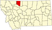
Ethridge is an unincorporated community in Toole County, Montana, United States. It is located 12.6 miles (20.3 km) west-northwest of Shelby. It is located on U.S. Route 2, and is a grain storage and shipping point on the Hi-Line. The community has a post office with ZIP code 59435.[2][3]
Glacier Wind Farm is located south of Ethridge off U.S. Route 2, between the cities of Cut Bank and Shelby, and spans about 25,000 acres.[4]
Sometime in early 1900, the Great Northern Railway station named Galt was renamed Ethridge.[5]
References
- ^ "Ethridge". Geographic Names Information System. United States Geological Survey, United States Department of the Interior.
- ^ United States Postal Service (2012). "USPS - Look Up a ZIP Code". Retrieved February 15, 2012.
- ^ "Postmaster Finder - Post Offices by ZIP Code". United States Postal Service. Archived from the original on April 28, 2019. Retrieved July 8, 2014.
- ^ LeAnne Kavanagh (July 23, 2008). "NaturEner shows off $500 million Glacier Wind farm". Cut Bank Pioneer Press.
- ^ "Ethridge". Montana Place Names Companion. Montana Historical Society. Retrieved April 2, 2021.
External links
- Ethridge, Montana’s Beautiful Grain Elevator, Take My Trip.com
- v
- t
- e
Municipalities and communities of Toole County, Montana, United States
County seat: Shelby
communities
- Montana portal
- United States portal
 | This Toole County, Montana state location article is a stub. You can help Wikipedia by expanding it. |
- v
- t
- e


