Drachselsried
You can help expand this article with text translated from the corresponding article in German. (March 2009) Click [show] for important translation instructions.
- View a machine-translated version of the German article.
- Machine translation, like DeepL or Google Translate, is a useful starting point for translations, but translators must revise errors as necessary and confirm that the translation is accurate, rather than simply copy-pasting machine-translated text into the English Wikipedia.
- Do not translate text that appears unreliable or low-quality. If possible, verify the text with references provided in the foreign-language article.
- You must provide copyright attribution in the edit summary accompanying your translation by providing an interlanguage link to the source of your translation. A model attribution edit summary is
Content in this edit is translated from the existing German Wikipedia article at [[:de:Drachselsried]]; see its history for attribution. - You may also add the template
{{Translated|de|Drachselsried}}to the talk page. - For more guidance, see Wikipedia:Translation.
Municipality in Bavaria, Germany

Coat of arms
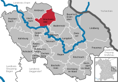
Location of Drachselsried within Regen district
(2022-12-31)[2]
94256
Drachselsried is a municipality in the district of Regen, in Bavaria, Germany. Drachselsried is in the Zeller Valley (German: Zellertal), and is part of the Glass Road (Glasstrasse) The area is part of the Bavarian Forest National Park. The village is a small, highly organised, friendly place to live. Bayern Eins, the German radio station, gave some history details of the village, which was first noted in 1184. The village continues to grow with the addition in 2017 of a retirement home with private apartments, close to the village centre. A number of new homes have been built on land available for purchase from the local council.
References
- ^ Liste der ersten Bürgermeister/Oberbürgermeister in kreisangehörigen Gemeinden, Bayerisches Landesamt für Statistik, 15 July 2021.
- ^ Genesis Online-Datenbank des Bayerischen Landesamtes für Statistik Tabelle 12411-003r Fortschreibung des Bevölkerungsstandes: Gemeinden, Stichtag (Einwohnerzahlen auf Grundlage des Zensus 2011).
External links
- https://www.drachselsried.eu Archived 2022-01-17 at the Wayback Machine
- v
- t
- e
Towns and municipalities in Regen (district)
- Achslach
- Arnbruck
- Bayerisch Eisenstein
- Bischofsmais
- Böbrach
- Bodenmais
- Drachselsried
- Frauenau
- Geiersthal
- Gotteszell
- Kirchberg im Wald
- Kirchdorf im Wald
- Kollnburg
- Langdorf
- Lindberg
- Patersdorf
- Prackenbach
- Regen
- Rinchnach
- Ruhmannsfelden
- Teisnach
- Viechtach
- Zachenberg
- Zwiesel

Authority control databases | |
|---|---|
| International |
|
| National |
|
 | This Regen district location article is a stub. You can help Wikipedia by expanding it. |
- v
- t
- e


