Dolná Ves
Village in Slovakia
48°39′56″N 18°54′45″E / 48.66556°N 18.91250°E / 48.66556; 18.91250 (2021)
966 31[3]
Dolná Ves (before 1948(?): Šváb, older: Šváby; German: Schwabendorf; Hungarian: Sváb) is a village and municipality in Žiar nad Hronom District in the Banská Bystrica Region of central Slovakia. It is near the town of Kremnica.
The first written record about the village is from the year 1427 (Schwabendorff), when the village became the property of Kremnica. Dolná Ves was part of Kremnica in the Middle Ages and from 1808 to 1882. The village was founded by German colonists[citation needed].
Gallery
-
 View from a nearby hill
 -
 Žliebok
 -
 Ďurova Skala, Kremnica Mountains
 -
 Jastrabská skala, Kremnica Mountains
 -
 The church
 -
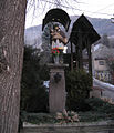 Statue of Saint John Nepomucene


Genealogical resources
The records for genealogical research are available at the state archive "Statny Archiv in Banska Bystrica, Slovakia"
- Roman Catholic church records (births/marriages/deaths): 1674-1913 (parish B)
- Lutheran church records (births/marriages/deaths): 1666-1891 (parish B)
See also
References
- ^ "Počet obyvateľov podľa pohlavia - obce (ročne)". www.statistics.sk (in Slovak). Statistical Office of the Slovak Republic. 2022-03-31. Retrieved 2022-03-31.
- ^ a b "Hustota obyvateľstva - obce [om7014rr_ukaz: Rozloha (Štvorcový meter)]". www.statistics.sk (in Slovak). Statistical Office of the Slovak Republic. 2022-03-31. Retrieved 2022-03-31.
- ^ a b c d "Základná charakteristika". www.statistics.sk (in Slovak). Statistical Office of the Slovak Republic. 2015-04-17. Retrieved 2022-03-31.
- ^ a b "Hustota obyvateľstva - obce". www.statistics.sk (in Slovak). Statistical Office of the Slovak Republic. 2022-03-31. Retrieved 2022-03-31.
- ^ SODB - Dolná Ves, 2011
- ^ SODB - Dolná Ves, 2011
External links
- https://web.archive.org/web/20080111223415/http://www.statistics.sk/mosmis/eng/run.html.
- http://www.e-obce.sk/obec/dolnaves/dolna-ves.html
- Surnames of living people in Dolna Ves
- v
- t
- e
Municipalities of Žiar nad Hronom District
- Bartošova Lehôtka
- Bzenica
- Dolná Trnávka
- Dolná Ves
- Dolná Ždaňa
- Hliník nad Hronom
- Horná Ves
- Horná Ždaňa
- Hronská Dúbrava
- Ihráč
- Janova Lehota
- Jastrabá
- Kopernica
- Kosorín
- Krahule
- Kremnické Bane
- Kunešov
- Ladomerská Vieska
- Lehôtka pod Brehmi
- Lovča
- Lovčica-Trubín
- Lúčky
- Lutila
- Nevoľné
- Pitelová
- Prestavlky
- Prochot
- Repište
- Sklené Teplice
- Slaská
- Stará Kremnička
- Trnavá Hora
- Vyhne

 | This Banská Bystrica Region geography article is a stub. You can help Wikipedia by expanding it. |
- v
- t
- e


