Delaware County Regional Airport
Airport in Indiana, United States of America

MIE
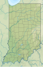
Location of airport in Indiana/United States
Show map of Indiana
MIE
MIE (the United States)
Show map of the United States| Direction | Length | Surface | |
|---|---|---|---|
| ft | m | ||
| 14/32 | 6,500 | 1,981 | Asphalt |
| 2/20 | 5,198 | 1,584 | Asphalt |
| Aircraft operations | 23,644 |
|---|---|
| Based aircraft | 22 |
Source: Federal Aviation Administration[1]
Delaware County Regional Airport[1][2] (IATA: MIE[3], ICAO: KMIE, FAA LID: MIE) is in Delaware County, Indiana[1] three miles northwest of Muncie.[1] Owned by the Delaware County Airport Authority,[1] it was formerly Delaware County Airport and Johnson Field.[4] The National Plan of Integrated Airport Systems for 2011–2015 categorized it as a general aviation facility.
Facilities
The airport covers 963 acres (390 ha) at an elevation of 937 feet (286 m). It has two asphalt runways: 14/32 is 6,500 by 150 feet (1,981 x 46 m) and 2/20 is 5,198 by 100 feet (1,584 x 30 m).[1]
In 2010 the airport had 23,644 aircraft operations, average 64 per day: 95% general aviation, 3% military, 2% air taxi, and 0% airline. It was home base to 22 aircraft: 86.5% single-engine, 4.5% multi-engine, 4.5% jet, and 4.5% helicopter.[1]
Scheduled airlines
Airline flights started in 1958—Lake Central DC-3s. In 1981 Allegheny Commuter flew to Chicago-O'Hare and Indianapolis.[5][6] By 1985 flights to Chicago were on Britt Airways[7] and Indianapolis flights had ended. Great Lakes Airlines operated flights to and from Chicago's O'Hare International Airport in the 1990s.
Businesses
- Muncie Aviation Company, the fixed-base operator (FBO).[8]
See also
References
- ^ a b c d e f g FAA Airport Form 5010 for MIE PDF. Federal Aviation Administration. Effective November 15, 2012.
- ^ "Delaware County Regional Airport" (PDF). Small Community Air Service Development Program. August 2010.
- ^ "IATA Airport Code Search (MIE: Delaware County)". International Air Transport Association. Retrieved August 8, 2013.
- ^ "KMIE – Delaware County Airport (Johnson Field)". FAA data republished by AirNav. February 11, 2010. Archived from the original on April 7, 2010.
- ^ Airlines and Aircraft Serving Chicago O'Hare Effective April 1, 1981, Departed Flights, Retrieved 2014-08-29
- ^ Airlines and Aircraft Serving Indianapolis Effective April 1, 1981, Departed Flights, Retrieved 2014-08-29
- ^ Airlines and Aircraft Serving Chicago O'Hare Effective February 15, 1985, Departed Flights, Retrieved 2014-08-29
- ^ "Muncie Aviation Company". Official site. Archived from the original on September 8, 2013. Retrieved August 8, 2013.
External links
- Official website
- Aerial photo from Indiana DOT at the Wayback Machine (archived August 15, 2010)
- Aerial image as of April 1998 from USGS The National Map
- FAA Airport Diagram for MIE (PDF), effective June 13, 2024
- FAA Terminal Procedures for MIE, effective June 13, 2024
- Resources for this airport:
- FAA airport information for MIE
- AirNav airport information for KMIE
- ASN accident history for MIE
- FlightAware airport information and live flight tracker
- NOAA/NWS weather observations: current, past three days
- SkyVector aeronautical chart, Terminal Procedures
- v
- t
- e
Airports in Indiana
- Anderson
- Arens
- Columbus
- Crawfordsville
- DeKalb County
- Delaware County
- Delphi
- Elkhart
- Frankfort
- Freeman
- French Lick
- Fulton County
- Gary/Chicago
- Goshen
- Greensburg
- Greenwood
- Grissom
- Huntingburg
- Huntington
- Indianapolis Heliport
- Jasper County
- Kendallville
- Kentland
- Kokomo
- La Porte
- Logansport–Cass County
- Madison
- Marion
- Mettel
- Michigan City
- Monroe County
- New Castle–Henry County
- North Vernon
- Paoli
- Perry County
- Peru
- Plymouth
- Porter County
- Portland
- Purdue University
- Putnam
- Randolph
- Richmond
- Salem
- Shelbyville
- Sheridan
- Smith
- Starke County
- Steuben County
- Sullivan County
- Terre Haute
- Wabash
- Warsaw
- White County
- http://www.muncie-airport.com/


