Coxixola
Municipality in Northeast, Brazil

Coat of arms

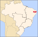
Location in Paraíba state
(2020 [1])
Coxixola is the smallest municipality located in Paraíba state, Brazil. The population is 1,935 people (2020). The total area is 113.6 km². Coxixola was a district firstly of São João do Cariri-PB and after of Serra Branca-PB until 1994 when it became a municipality itself.
The word coxixola means to build a small house using clay bricks in Tupi-Guarany Indian language.
References
- ^ IBGE 2020
External links
- Official website
- v
- t
- e

Capital: João Pessoa
Agreste Paraibano
| Brejo Paraibano | |
|---|---|
| Campina Grande | |
| Curimatau Ocidental | |
| Curimatau Oriental | |
| Esperanca | |
| Guarabira | |
| Itabaiana | |
| Umbuzeiro |
Borborema
| Cariri Ocidental | |
|---|---|
| Cariri Oriental | |
| Serido Ocidental Paraibano | |
| Serido Oriental Paraibano |
Mata Paraibana
| João Pessoa | |
|---|---|
| Litoral Norte | |
| Litoral Sul | |
| Sape |
Sertao Paraibano
| Cajazeiras | |
|---|---|
| Catole do Rocha | |
| Itaporanga | |
| Patos | |
| Pianco | |
| Serra do Teixeira | |
| Sousa |
 | This Paraíba, Brazil location article is a stub. You can help Wikipedia by expanding it. |
- v
- t
- e


