Brou-sur-Chantereine
Commune in Île-de-France, France

Coat of arms
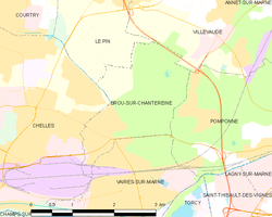
Location of Brou-sur-Chantereine

(2020–2026) Stéphanie Barnier[1]
1
(2021)[2]
77055 /77177
Brou-sur-Chantereine (French pronunciation: [bʁu syʁ ʃɑ̃tʁɛn] ⓘ) is a commune in the Seine-et-Marne department, in the Île-de-France region, north-central France.
Population
| Year | Pop. | ±% p.a. |
|---|---|---|
| 1968 | 3,269 | — |
| 1975 | 4,664 | +5.21% |
| 1982 | 4,429 | −0.74% |
| 1990 | 4,469 | +0.11% |
| 1999 | 4,280 | −0.48% |
| 2007 | 4,253 | −0.08% |
| 2012 | 4,393 | +0.65% |
| 2017 | 4,382 | −0.05% |
| Source: INSEE[3] | ||
Inhabitants are called Breuillois in French.
See also
References
- ^ "Répertoire national des élus: les maires" (in French). data.gouv.fr, Plateforme ouverte des données publiques françaises. 13 September 2022.
- ^ "Populations légales 2021". The National Institute of Statistics and Economic Studies. 28 December 2023.
- ^ Population en historique depuis 1968, INSEE
External links
Wikimedia Commons has media related to Brou-sur-Chantereine.
- 1999 Land Use, from IAURIF (Institute for Urban Planning and Development of the Paris-Île-de-France région) (in English)
- Base Mérimée: Search for heritage in the commune, Ministère français de la Culture. (in French)
- v
- t
- e
 Communes of the Seine-et-Marne department
- Achères-la-Forêt
- Amillis
- Amponville
- Andrezel
- Annet-sur-Marne
- Arbonne-la-Forêt
- Argentières
- Armentières-en-Brie
- Arville
- Aubepierre-Ozouer-le-Repos
- Aufferville
- Augers-en-Brie
- Aulnoy
- Avon
- Baby
- Bagneaux-sur-Loing
- Bailly-Romainvilliers
- Balloy
- Bannost-Villegagnon
- Barbey
- Barbizon
- Barcy
- Bassevelle
- Bazoches-lès-Bray
- Beauchery-Saint-Martin
- Beaumont-du-Gâtinais
- Beautheil-Saints
- Beauvoir
- Bellot
- Bernay-Vilbert
- Beton-Bazoches
- Bezalles
- Blandy
- Blennes
- Boisdon
- Bois-le-Roi
- Boissettes
- Boissise-la-Bertrand
- Boissise-le-Roi
- Boissy-aux-Cailles
- Boissy-le-Châtel
- Boitron
- Bombon
- Bougligny
- Boulancourt
- Bouleurs
- Bourron-Marlotte
- Boutigny
- Bransles
- Bray-sur-Seine
- Bréau
- Brie-Comte-Robert
- La Brosse-Montceaux
- Brou-sur-Chantereine
- Burcy
- Bussières
- Bussy-Saint-Georges
- Bussy-Saint-Martin
- Buthiers
- Cannes-Écluse
- Carnetin
- La Celle-sur-Morin
- Cély
- Cerneux
- Cesson
- Cessoy-en-Montois
- Chailly-en-Bière
- Chailly-en-Brie
- Chaintreaux
- Chalautre-la-Grande
- Chalautre-la-Petite
- Chalifert
- Chalmaison
- Chambry
- Chamigny
- Champagne-sur-Seine
- Champcenest
- Champdeuil
- Champeaux
- Champs-sur-Marne
- Changis-sur-Marne
- Chanteloup-en-Brie
- La Chapelle-Gauthier
- La Chapelle-Iger
- La Chapelle-la-Reine
- La Chapelle-Moutils
- La Chapelle-Rablais
- La Chapelle-Saint-Sulpice
- Les Chapelles-Bourbon
- Charmentray
- Charny
- Chartrettes
- Chartronges
- Châteaubleau
- Château-Landon
- Le Châtelet-en-Brie
- Châtenay-sur-Seine
- Châtenoy
- Châtillon-la-Borde
- Châtres
- Chauconin-Neufmontiers
- Chauffry
- Chaumes-en-Brie
- Chelles
- Chenoise-Cucharmoy
- Chenou
- Chessy
- Chevrainvilliers
- Chevru
- Chevry-Cossigny
- Chevry-en-Sereine
- Choisy-en-Brie
- Citry
- Claye-Souilly
- Clos-Fontaine
- Cocherel
- Collégien
- Combs-la-Ville
- Compans
- Conches-sur-Gondoire
- Condé-Sainte-Libiaire
- Congis-sur-Thérouanne
- Coubert
- Couilly-Pont-aux-Dames
- Coulombs-en-Valois
- Coulommes
- Coulommiers
- Coupvray
- Courcelles-en-Bassée
- Courchamp
- Courpalay
- Courquetaine
- Courtacon
- Courtomer
- Courtry
- Coutençon
- Coutevroult
- Crécy-la-Chapelle
- Crégy-lès-Meaux
- Crèvecœur-en-Brie
- Crisenoy
- Croissy-Beaubourg
- La Croix-en-Brie
- Crouy-sur-Ourcq
- Cuisy
- Dagny
- Dammarie-lès-Lys
- Dammartin-en-Goële
- Dammartin-sur-Tigeaux
- Dampmart
- Darvault
- Dhuisy
- Diant
- Donnemarie-Dontilly
- Dormelles
- Doue
- Douy-la-Ramée
- Échouboulains
- Les Écrennes
- Égligny
- Égreville
- Émerainville
- Esbly
- Esmans
- Étrépilly
- Everly
- Évry-Grégy-sur-Yerre
- Faremoutiers
- Favières
- Faÿ-lès-Nemours
- Féricy
- Férolles-Attilly
- Ferrières-en-Brie
- La Ferté-Gaucher
- La Ferté-sous-Jouarre
- Flagy
- Fleury-en-Bière
- Fontainebleausubpr
- Fontaine-Fourches
- Fontaine-le-Port
- Fontains
- Fontenailles
- Fontenay-Trésigny
- Forfry
- Forges
- Fouju
- Fresnes-sur-Marne
- Frétoy
- Fromont
- Fublaines
- Garentreville
- Gastins
- La Genevraye
- Germigny-l'Évêque
- Germigny-sous-Coulombs
- Gesvres-le-Chapitre
- Giremoutiers
- Gironville
- Gouaix
- Gouvernes
- La Grande-Paroisse
- Grandpuits-Bailly-Carrois
- Gravon
- Gressy
- Gretz-Armainvilliers
- Grez-sur-Loing
- Grisy-Suisnes
- Grisy-sur-Seine
- Guérard
- Guercheville
- Guermantes
- Guignes
- Gurcy-le-Châtel
- Hautefeuille
- La Haute-Maison
- Héricy
- Hermé
- Hondevilliers
- La Houssaye-en-Brie
- Ichy
- Isles-les-Meldeuses
- Isles-lès-Villenoy
- Iverny
- Jablines
- Jaignes
- Jaulnes
- Jossigny
- Jouarre
- Jouy-le-Châtel
- Jouy-sur-Morin
- Juilly
- Jutigny
- Lagny-sur-Marne
- Larchant
- Laval-en-Brie
- Léchelle
- Lescherolles
- Lesches
- Lésigny
- Leudon-en-Brie
- Lieusaint
- Limoges-Fourches
- Lissy
- Liverdy-en-Brie
- Livry-sur-Seine
- Lizines
- Lizy-sur-Ourcq
- Lognes
- Longperrier
- Longueville
- Lorrez-le-Bocage-Préaux
- Louan-Villegruis-Fontaine
- Luisetaines
- Lumigny-Nesles-Ormeaux
- Luzancy
- Machault
- La Madeleine-sur-Loing
- Magny-le-Hongre
- Maincy
- Maisoncelles-en-Brie
- Maisoncelles-en-Gâtinais
- Maison-Rouge
- Marchémoret
- Marcilly
- Les Marêts
- Mareuil-lès-Meaux
- Marles-en-Brie
- Marolles-en-Brie
- Marolles-sur-Seine
- Mary-sur-Marne
- Mauperthuis
- Mauregard
- May-en-Multien
- Meauxsubpr
- Le Mée-sur-Seine
- Meigneux
- Meilleray
- Melunpref
- Melz-sur-Seine
- Méry-sur-Marne
- Le Mesnil-Amelot
- Messy
- Misy-sur-Yonne
- Mitry-Mory
- Moisenay
- Moissy-Cramayel
- Mondreville
- Mons-en-Montois
- Montceaux-lès-Meaux
- Montceaux-lès-Provins
- Montcourt-Fromonville
- Montdauphin
- Montenils
- Montereau-Fault-Yonne
- Montereau-sur-le-Jard
- Montévrain
- Montgé-en-Goële
- Monthyon
- Montigny-le-Guesdier
- Montigny-Lencoup
- Montigny-sur-Loing
- Montmachoux
- Montolivet
- Montry
- Moret-Loing-et-Orvanne
- Mormant
- Mortcerf
- Mortery
- Mouroux
- Mousseaux-lès-Bray
- Moussy-le-Neuf
- Moussy-le-Vieux
- Mouy-sur-Seine
- Nandy
- Nangis
- Nanteau-sur-Essonne
- Nanteau-sur-Lunain
- Nanteuil-lès-Meaux
- Nanteuil-sur-Marne
- Nantouillet
- Nemours
- Neufmoutiers-en-Brie
- Noisiel
- Noisy-Rudignon
- Noisy-sur-École
- Nonville
- Noyen-sur-Seine
- Obsonville
- Ocquerre
- Oissery
- Orly-sur-Morin
- Ormesson
- Les Ormes-sur-Voulzie
- Othis
- Ozoir-la-Ferrière
- Ozouer-le-Voulgis
- Paley
- Pamfou
- Paroy
- Passy-sur-Seine
- Pécy
- Penchard
- Perthes
- Pézarches
- Pierre-Levée
- Le Pin
- Le Plessis-aux-Bois
- Le Plessis-Feu-Aussoux
- Le Plessis-l'Évêque
- Le Plessis-Placy
- Poigny
- Poincy
- Poligny
- Pommeuse
- Pomponne
- Pontault-Combault
- Pontcarré
- Précy-sur-Marne
- Presles-en-Brie
- Pringy
- Provinssubpr
- Puisieux
- Quiers
- Quincy-Voisins
- Rampillon
- Réau
- Rebais
- Recloses
- Remauville
- Reuil-en-Brie
- La Rochette
- Roissy-en-Brie
- Rouilly
- Rouvres
- Rozay-en-Brie
- Rubelles
- Rumont
- Rupéreux
- Saâcy-sur-Marne
- Sablonnières
- Saint-Augustin
- Saint-Barthélemy
- Saint-Brice
- Saint-Cyr-sur-Morin
- Saint-Denis-lès-Rebais
- Sainte-Aulde
- Sainte-Colombe
- Saint-Fargeau-Ponthierry
- Saint-Fiacre
- Saint-Germain-Laval
- Saint-Germain-Laxis
- Saint-Germain-sous-Doue
- Saint-Germain-sur-École
- Saint-Germain-sur-Morin
- Saint-Hilliers
- Saint-Jean-les-Deux-Jumeaux
- Saint-Just-en-Brie
- Saint-Léger
- Saint-Loup-de-Naud
- Saint-Mammès
- Saint-Mard
- Saint-Mars-Vieux-Maisons
- Saint-Martin-des-Champs
- Saint-Martin-du-Boschet
- Saint-Martin-en-Bière
- Saint-Méry
- Saint-Mesmes
- Saint-Ouen-en-Brie
- Saint-Ouen-sur-Morin
- Saint-Pathus
- Saint-Pierre-lès-Nemours
- Saint-Rémy-de-la-Vanne
- Saint-Sauveur-lès-Bray
- Saint-Sauveur-sur-École
- Saint-Siméon
- Saint-Soupplets
- Saint-Thibault-des-Vignes
- Salins
- Sammeron
- Samois-sur-Seine
- Samoreau
- Sancy
- Sancy-lès-Provins
- Savigny-le-Temple
- Savins
- Seine-Port
- Sept-Sorts
- Serris
- Servon
- Signy-Signets
- Sigy
- Sivry-Courtry
- Sognolles-en-Montois
- Soignolles-en-Brie
- Soisy-Bouy
- Solers
- Souppes-sur-Loing
- Sourdun
- Tancrou
- Thénisy
- Thieux
- Thomery
- Thorigny-sur-Marne
- Thoury-Férottes
- Tigeaux
- La Tombe
- Torcysubpr
- Touquin
- Tournan-en-Brie
- Tousson
- La Trétoire
- Treuzy-Levelay
- Trilbardou
- Trilport
- Trocy-en-Multien
- Ury
- Ussy-sur-Marne
- Vaires-sur-Marne
- Valence-en-Brie
- Vanvillé
- Varennes-sur-Seine
- Varreddes
- Vaucourtois
- Le Vaudoué
- Vaudoy-en-Brie
- Vaux-le-Pénil
- Vaux-sur-Lunain
- Vendrest
- Verdelot
- Verneuil-l'Étang
- Vernou-la-Celle-sur-Seine
- Vert-Saint-Denis
- Vieux-Champagne
- Vignely
- Villebéon
- Villecerf
- Villemaréchal
- Villemareuil
- Villemer
- Villenauxe-la-Petite
- Villeneuve-le-Comte
- Villeneuve-les-Bordes
- Villeneuve-Saint-Denis
- Villeneuve-sous-Dammartin
- Villeneuve-sur-Bellot
- Villenoy
- Villeparisis
- Villeroy
- Ville-Saint-Jacques
- Villevaudé
- Villiers-en-Bière
- Villiers-Saint-Georges
- Villiers-sous-Grez
- Villiers-sur-Morin
- Villiers-sur-Seine
- Villuis
- Vimpelles
- Vinantes
- Vincy-Manœuvre
- Voinsles
- Voisenon
- Voulangis
- Voulton
- Voulx
- Vulaines-lès-Provins
- Vulaines-sur-Seine
- Yèbles
- pref: prefecture
- subpr: subprefecture
Authority control databases | |
|---|---|
| International |
|
| National |
|
| Geographic |
|
| Other |
|
 | This article related to a Seine-et-Marne location is a stub. You can help Wikipedia by expanding it. |
- v
- t
- e


