Aliwal Shoal Marine Protected Area

Marine conservation area at Aliwal Shoal off the coast of KwaZulu-Natal, South Africa
Aliwal Shoal Marine Protected Area is located in South Africa
Aliwal Shoal Marine Protected Area
Aliwal Shoal Marine Protected Area (South Africa)

The Aliwal Shoal Marine Protected Area is a coastal and offshore marine protected area between the Lovu and Mzimayi estuaries, off the KwaZulu-Natal South Coast, South Africa.[1] The MPA contains the popular scuba diving destination Aliwal Shoal

History

The MPA was established in 1991 and proclaimed by the Minister of Environmental Affairs and Tourism, (Marthinus van Schalkwyk, in Government Gazette No. 26431 of 4 June 2004 in terms of section 43 of the) Marine Living Resources Act, 18 of 1998.[2] The Aliwal Shoal MPA was extended by the addition of the large Aliwal Shoal Offshore Marine Protected Area in 2018/2019.[1]

Purpose

A marine protected area is defined by the IUCN as "A clearly defined geographical space, recognised, dedicated and managed, through legal or other effective means, to achieve the long-term conservation of nature with associated ecosystem services and cultural values".[2]

Extent

Map of the extent of the Aliwal Shoal Marine Protected Area showing zonation and bathymetry
Bathymety of the older parts of the Aliwal Shoal MPA
Bathymetry of the Crown area and Produce restricted zones.

The protected area includes the seabed, subsoil and water column inside the boundaries.[1] Length of coastline protected since 2004 is 18,30 km[2] The area of ocean protected previous to the 2018 extension was 126 km2.[2] now 670 km2.

Zonation

The MPA is divided into an inshore and an offshore area. It is further subdivided into an offshore controlled-pelagic zone, two offshore controlled zones, an inshore controlled zone, an inshore restricted zone, four offshore restricted zones and two inshore sanctuary zones.[1]

Boundaries

The borders of the MPA are:[3][4]

  • Northern boundary from S30°7.000′ E30°51.154′ to S30°7.000′ E31°2.000′
  • Eastern boundary from S30°7.000′ E31°2.000′ to S30°22.412′ E31°2.000′
  • Southern boundary from S30°22.412′ E31°2.000′ to S30°22.410′ E30°47.530′
  • South-western boundary from S30°22.410′ E30°47.530′ to S30°20.816′ E30°43.640′
  • Western boundary from S30°20.816′ E30°43.640′ to S30°7.000′ E30°51.154′ along the high-water mark.

Restricted zones

Aliwal Shoal inshore restricted zone:[1]

  • Part of the intertidal portion of the Aliwal Shoal Marine Protected Area from S30°14.420’, E30°47.071’ to S30°16.193’, E30°45.814’ between the high water mark and the five meter depth contour.

Aliwal Shoal offshore restricted zone (ASORZ):[4]

  • Northern boundary: S30°10.601', E30°52.5′ to S30°10.601', E30°54.498′; S30°9.8', E30°54.498′ to S30°9.8′ E30°52.5’ and S30°7.0’, E30°52.5’ to S30°7.0’, E31°2’
  • Eastern boundary: S30°7.0’, E31°2’ to S30°22.412’, E31°2’
  • Southern boundary: S30°22.412’, E31°2’ to S30°22.412’, E30°52.5’
  • Western boundary: S30°22.412’, E30°52.5’ to S30°10.601', E30°52.5′; S30°10.601', E30°54.498′ to S30°9.8', E30°54.498′ and S30°9.8′ E30°52.5’ to S30°7.0’, E30°52.5’

Ngane Offshore Restricted Zone (NORZ):[4]

  • Northern boundary: S30°10.8’, E30°49.2’ to S30°10.8’, E30°50.3’
  • Eastern boundary: S30°10.8’, E30°50.3’ to S30°11.9’, E30°50.3’
  • Southern boundary: S30°11.9’, E30°50.3’ to S30°11.9’, E30°49.2’
  • Western boundary: S30°11.9’, E30°49.2’ to S30°10.8’, E30°49.2’

Produce Offshore Restricted Zone (PORZ):[4]

  • Northern boundary: S30°14.968′, E30°49.723′ to S30°14.985′, E30°49.846′
  • Eastern boundary: S30°14.985′, E30°49.846′ to S30°15.093′, E30°49.827′
  • Southern boundary: S30°15.093′, E30°49.827′ to S30°15.076′, E30°49.703′
  • Western boundary: S30°15.076′, E30°49.703′ to S30°14.968′, E30°49.723′

Crown Offshore Restricted Zone (CORZ) is enclosed by twelve line segments between waypoints which lie on the 25 meter isobath.[4]

  • S30°15.600′, E30°49.776′ to S30°15.791′, E30°49.714′
  • S30°15.791′, E30°49.714′ to S30°15.982′, E30°49.627′
  • S30°15.982′, E30°49.627′ to S30°15.982′, E30°49.627′
  • S30°16.270′, E30°49.409′ to S30°16.270′, E30°49.409′
  • S30°16.673′, E30°49.078′ to S30°16.673′, E30°49.078′
  • S30°16.926′, E30°48.835′ to S30°16.926′, E30°48.835′
  • S30°16.800′, E30°48.600′ to S30°16.800′, E30°48.600′
  • S30°16.680′, E30°48.376′ to S30°16.680′, E30°48.376′
  • S30°16.189′, E30°48.834′ to S30°16.189′, E30°48.834′
  • S30°15.908′, E30°49.143′ to S30°15.908′, E30°49.143′
  • S30°15.518′, E30°49.589′ to S30°15.518′, E30°49.589′
  • S30°15.474′, E30°49.671′ to S30°15.474′, E30°49.671′

Controlled zones

Aliwal Shoal inshore controlled zone is the rest of the high-water to five metre isobath inshore portion of the MPA excepting the two sanctuary zones and the restricted zone.[1]

Aliwal Shoal controlled-pelagic zone:[1]

  • Northern boundary: S30°8.5’, E30° 50.33’ to S30°8.5’, E30°52.5’
  • Eastern boundary: S30°8.5’, E30°52.5’ to S30°17.3’, E30°52.5’
  • Southern boundary: S30°17.3’, E30°52.5’ to S30°17.3’, E30°45.586’
  • Western boundary S30°17.3’, E30°45.586’ to S30°8.5’, E30° 50.33’

Aliwal Shoal controlled zone 1:[1]

  • Northern boundary* S30°7’, E30°51.154’ to S31°7’, E31°2’
  • Eastern boundary: S31°7’, E31°2’ to S30°8.5’, E31°2’
  • Southern boundary: S30°8.5’, E31°2’ to S30°8.5’, E30°52.5’ to S30°8.5’, E30°50.33’
  • Western boundary: S30°8.5’, E30°50.33’ to S30°7’, E30°51.154’ along the five metre depth contour.

Aliwal Shoal controlled zone 2[1]

  • Northern boundary: S30°17.3’, E30°45.586’ to S30°17.3’, E30°52.5’
  • Eastern boundary: S30°17.3’, E30°52.5’ to S30°22.412’, E30°52.5’
  • Southern boundary: S30°22.412’, E30°52.5’ to S30°47’, E30°22’
  • Southwestern boundary: S30°47’, E30°22’ to S30°48’, E30°11.9’
  • Western boundary: S30°48’, E30°11.9’ to S30°17.3’, E30°45.586’ along the five metre depth contour.

Sanctuary zones

Aliwal Shoal inshore sanctuary zone 1:[1]

  • Part of the intertidal portion of the Aliwal Shoal Marine Protected Area, from S30°13.464’, E30°47.694’ to S30°14.420’, E30°47.071’ between the high water mark and the five metre depth contour.

Aliwal Shoal inshore sanctuary zone 2:[1]

  • Part of the intertidal portion of the Aliwal Shoal Marine Protected Area, from S30°20.404’, E30°44.003’ to S30°20.807’, E30°43.618’ between the high water mark and the five meter depth contour.

Management

The marine protected areas of South Africa are the responsibility of the national government, which has management agreements with a variety of MPA management authorities, in this case, Ezemvelo KZN Wildlife, which manages the MPA with funding from the SA Government through the Department of Environmental Affairs (DEA).[2]

The Department of Agriculture, Forestry and Fisheries is responsible for issuing permits, quotas and law enforcement.[5]

Use

Activities requiring a permit

Fishing

The game and bait fish that be caught in the controlled-pelagic zone of the MPA are in the following families, and all species in these families may be caught.[1]

Pelagic gamefish species:

  • Carangidae
  • Coryphaenidae
  • Istiophoridae
  • Pomatomidae
  • Rachycentridae
  • Scombridae
  • Sphyraenidae
  • Xiphiidae

Pelagic baitfish species:

Scuba diving

Operating a recreational scuba diving business in the MPA requires a permit.[1]

Named dive sites

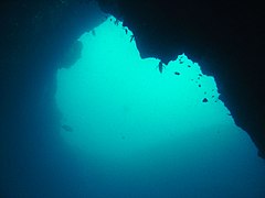
The MPA has a large number of rocky reef and wreck recreational dive sites which have been identified by position and named:[6]

  • Cathedral 30°15′52″S 30°49′39″E / 30.2644°S 30.8276°E / -30.2644; 30.8276
  • Eelskin Ridge 30°15′48″S 30°49′25″E / 30.2634°S 30.8236°E / -30.2634; 30.8236
  • Fern Coral reef 30°18′29″S 30°46′05″E / 30.308°S 30.768°E / -30.308; 30.768
  • Howard's Castle 30°16′55″S 30°48′29″E / 30.282°S 30.808°E / -30.282; 30.808
  • Inside Eelskin 30°16′13″S 30°49′12″E / 30.2704°S 30.8201°E / -30.2704; 30.8201
  • Manta Point 30°15′36″S 30°49′44″E / 30.2599°S 30.8288°E / -30.2599; 30.8288
  • Northern Pinnacles 30°15′42″S 30°49′41″E / 30.2616°S 30.8280°E / -30.2616; 30.8280
  • North Sands 30°15′34″S 30°49′39″E / 30.2595°S 30.8275°E / -30.2595; 30.8275
  • Pinnacles 30°15′35″S 30°49′41″E / 30.2597°S 30.8280°E / -30.2597; 30.8280
  • Pinnacles 30°15′35″S 30°49′41″E / 30.2597°S 30.8280°E / -30.2597; 30.8280
  • Produce wreck 30°14′59″S 30°49′47″E / 30.2498°S 30.8296°E / -30.2498; 30.8296
  • Raggies Cave 30°15′43″S 30°49′40″E / 30.2619°S 30.8279°E / -30.2619; 30.8279
  • Shark Alley 30°15′44″S 30°49′42″E / 30.2621°S 30.8283°E / -30.2621; 30.8283
  • South Sands 30°15′49″S 30°49′37″E / 30.2636°S 30.8269°E / -30.2636; 30.8269
  • Stringer 30°16′16″S 30°49′25″E / 30.2710°S 30.8237°E / -30.2710; 30.8237

Prohibited activities

Geography

Ecology

Marine bioregions of the South African Exclusive Economic Zone: Aliwal Shoal Marine Protected Area is in the Natal coastal bioregion.

(describe position, biodiversity and endemism of the region) The MPA is in the warm temperate Natal inshore marine bioregion to the north-east of the Mbashe River.[7][8]

Four major habitats exist in the sea in this region, distinguished by the nature of the substrate. The substrate, or base material, is important in that it provides a base to which an organism can anchor itself, which is vitally important for those organisms which need to stay in one particular kind of place. Rocky shores and reefs provide a firm fixed substrate for the attachment of plants and animals. Sandy beaches and bottoms are a relatively unstable substrate and cannot anchor many of the other benthic organisms. Finally there is open water, above the substrate and clear of the kelp forest, where the organisms must drift or swim. Mixed habitats are also frequently found, which are a combination of those mentioned above.[9] There are no significant estuarine habitats in the MPA.

Rocky shores and reefs There are rocky reefs and mixed rocky and sandy bottoms. For many marine organisms the substrate is another type of marine organism, and it is common for several layers to co-exist. Examples of this are red bait pods, which are usually encrusted with sponges, ascidians, bryozoans, anemones, and gastropods, and abalone, which are usually covered by similar seaweeds to those found on the surrounding rocks, usually with a variety of other organisms living on the seaweeds.[9]: Ch.2 

The type of rock of the reef is of some importance, as it influences the range of possibilities for the local topography, which in turn influences the range of habitats provided, and therefore the diversity of inhabitants. Sandstone and other sedimentary rocks erode and weather very differently, and depending on the direction of dip and strike, and steepness of the dip, may produce reefs which are relatively flat to very high profile and full of small crevices. These features may be at varying angles to the shoreline and wave fronts. There are fewer large holes, tunnels and crevices in sandstone reefs, but often many deep but low near-horizontal crevices.

Coral reefs

Sedimentary beaches and bottoms (including mud, sand, shelly, pebble and gravel bottoms) Sedimentary bottoms at first glance appear to be fairly barren areas, as they lack the stability to support many of the spectacular reef based species, and the variety of large organisms is relatively low. The sediment is continually being moved around by wave action, to a greater or lesser degree depending on weather conditions and exposure of the area. This means that sessile organisms must be specifically adapted to areas of relatively loose substrate to thrive in them, and the variety of species found on a sandy or gravel bottom will depend on all these factors. unconsolidated sedimentary bottoms have one important compensation for their instability, animals can burrow into the sediment and move up and down within its layers, which can provide feeding opportunities and protection from predation. Other species can dig themselves holes in which to shelter, or may feed by filtering water drawn through the tunnel, or by extending body parts adapted to this function into the water above the sand.[9]: Ch.3 

The open sea

Marine species diversity

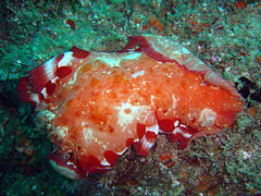
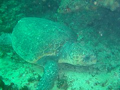
Animals

Seaweeds

  • Iridescent blues of a Dictotalean brown alga
    Iridescent blues of a Dictotalean brown alga

Endemism

Alien invasive species

Threats

Slipways and harbours in the MPA

There are no harbours in the MPA. Boats are launched directly into the sea from the beach, or when conditions allow, may be launched in a river and navigated through the river mouth.

See also

Map
Marine protected areas of South Africa[10][11]

References

  1. ^ a b c d e f g h i j k l m "R107 Draft Regulations for the management of the Aliwal Shoal Marine Protected Area" (PDF). Regulation Gazette No. 10553. 608 (39646). Pretoria: Government Printer. 3 February 2016. Archived from the original (PDF) on 7 February 2017. Retrieved 29 January 2019.
  2. ^ a b c d e "Marine Protected Areas". World Wildlife Fund. Retrieved 24 May 2018.
  3. ^ "R110 Draft Notice declaring the Aliwal Shoal Marine Protected Area under Section 22A of the National Environmental: Protected Areas Act,2003 (Act No, 57 of 2003)" (PDF). Regulation Gazette No. 10553. 608 (39646). Pretoria: Government Printer. 3 February 2016. Archived from the original (PDF) on 7 February 2017. Retrieved 29 January 2019.
  4. ^ a b c d e "Government notices R. 781 National Environmental Management: Protected Areas Act (57/2003): Regulations for the Management of the Aliwal Shoal Marine Protected Area" (PDF). Regulation Gazette No. 10177. 647 (42479). Pretoria: Government Printer. 23 May 2019.
  5. ^ "Marine Protected Area". Retrieved 26 May 2018.
  6. ^ "Standard positions for SeaKeys dive sites: Dive sites of the Cape Town region". iNaturalist.org. Retrieved 6 February 2019.
  7. ^ Jones, Georgina (2008). A field guide to the marine animals of the Cape Peninsula. Cape Town: SURG. ISBN 978-0-620-41639-9.
  8. ^ Sink, K.; Harris, J.; Lombard, A. (October 2004). Appendix 1. South African marine bioregions (PDF). South African National Spatial Biodiversity Assessment 2004: Technical Report Vol. 4 Marine Component DRAFT (Report). pp. 97–109.
  9. ^ a b c Branch, G.M.; Branch, M.L. (1985). The Living Shores of Southern Africa (3rd impression ed.). Cape Town: C. Struik. ISBN 0-86977-115-9.
  10. ^ "MPA Declarations" (PDF). Regulation Gazette No. 42478. 647 (10177). Pretoria: Government Printer. 23 May 2019.
  11. ^ "Protected Areas Register". dffeportal.environment.gov.za. Retrieved 10 July 2022.
  • v
  • t
  • e
National taxon checklists
Plants
Flowering
plants
Animals
Arthropods
Arachnids
  • Harvestmen
  • Microwhip scorpions
  • Pseudoscorpions
  • Scorpions
  • Shorttailed whipscorpions
  • Solifugae
  • Araneae
  • Ixodida
  • Whip spiders and tailless whip scorpions
Insects
  • Alderflies, dobsonflies and fishflies
  • Beetles
  • Booklice, barklice and barkflies
  • Butterflies and moths
  • Caddisflies
  • Cockroaches and termites
  • Dragonflies and damselflies
  • Earwigs
  • Fleas
  • Flies
  • Jumping bristletails
  • Lice
  • Mantises
  • Mayflies
  • Net-winged insects
  • Notoptera
  • Orthoptera
  • Sawflies, wasps, bees, and ants
  • Scorpionflies
  • Silverfish and firebrats
  • Stick and leaf insects
  • Stoneflies
  • Strepsiptera
  • Termites
  • Thrips
  • True bugs
  • Webspinners
Molluscs
Vertebrates
Seaweeds
Fungi
Related
Regional taxon checklists and other minor lists
Tropical and subtropical
moist broadleaf forests
Tropical and subtropical grasslands,
savannas, and shrublands
Montane grasslands
and shrublands
Mediterranean forests,
woodlands, and scrub
Deserts and xeric shrublands
Tundra
Mangroves
Marine ecoregions
Savanna
  • Andesite Mountain Bushveld
  • Aoub Duneveld
  • Barberton Serpentine Sourveld
  • Bhisho Thornveld
  • Cathedral Mopane Bushveld
  • Central Sandy Bushveld
  • Delagoa Lowveld
  • Dwaalboom Thornveld
  • Dwarsberg-Swartruggens Mountain Bushveld
  • Eastern Valley Bushveld
  • Gabbro Grassy Bushveld
  • Gauteng Shale Mountain Bushveld
  • Ghaap Plateau Vaalbosveld
  • Gold Reef Mountain Bushveld
  • Gordonia Duneveld
  • Gordonia Kameeldoring Bushveld
  • Gordonia Plains Shrubland
  • Granite Lowveld
  • Gravelotte Rocky Bushveld
  • Kaalrug Mountain Bushveld
  • Kathu Bushveld
  • Kimberley Thornveld
  • Koranna-Langeberg Mountain Bushveld
  • Kuruman Mountain Bushveld
  • Kuruman Thornveld
  • Kuruman Vaalbosveld
  • KwaZulu-Natal Hinterland Thornveld
  • KwaZulu-Natal Sandstone Sourveld
  • Lebombo Summit Sourveld
  • Legogote Sour Bushveld
  • Limpopo Ridge Bushveld
  • Limpopo Sweet Bushveld
  • Loskop Mountain Bushveld
  • Loskop Thornveld
  • Lowveld Rugged Mopaneveld
  • Madikwe Dolomite Bushveld
  • Mafikeng Bushveld
  • Makatini Clay Thicket
  • Makhado Sweet Bushveld
  • Makuleke Sandy Bushveld
  • Malelane Mountain Bushveld
  • Mamabolo Mountain Bushveld
  • Marikana Thornveld
  • Molopo Bushveld
  • Moot Plains Bushveld
  • Mopane Basalt Shrubland
  • Mopane Gabbro Shrubland
  • Musina Mopane Bushveld
  • Ngongoni Veld
  • Norite Koppies Bushveld
  • Northern Lebombo Bushveld
  • Northern Zululand Sourveld
  • Nossob Bushveld
  • Nwambyia-Pumbe Sandy Bushveld
  • Ohrigstad Mountain Bushveld
  • Olifantshoek Plains Thornveld
  • Phalaborwa-Timbavati Mopaneveld
  • Pilanesberg Mountain Bushveld
  • Polokwane Plateau Bushveld
  • Postmasburg Thornveld
  • Poung Dolomite Mountain Bushveld
  • Pretoriuskop Sour Bushveld
  • Roodeberg Bushveld
  • Schmidtsdrif Thornveld
  • Schweizer-Reneke Bushveld
  • Sekhukhune Mountain Bushveld
  • Sekhukhune Plains Bushveld
  • South Eastern Coastal Thornveld
  • Southern Lebombo Bushveld
  • Soutpansberg Mountain Bushveld
  • Springbokvlakte Thornveld
  • Stella Bushveld
  • Swaziland Sour Bushveld
  • Tembe Sandy Bushveld
  • Thukela Thornveld
  • Thukela Valley Bushveld
  • Tsende Mopaneveld
  • Tshokwane-Hlane Basalt Lowveld
  • Tzaneen Sour Bushveld
  • Vaalbos Rocky Shrubland
  • VhaVenda Miombo
  • Waterberg Mountain Bushveld
  • Western Maputaland Clay Bushveld
  • Western Maputaland Sandy Bushveld
  • Western Sandy Bushveld
  • Zeerust Thornveld
  • Zululand Coastal Thornveld
  • Zululand Lowveld
Grassland
  • Aliwal North Dry Grassland
  • Amathole Mistbelt Grassland
  • Amathole Montane Grassland
  • Amersfoort Highveld Clay Grassland
  • Barberton Montane Grassland
  • Basotho Montane Shrubland
  • Bedford Dry Grassland
  • Besemkaree Koppies Shrubland
  • Bloemfontein Dry Grassland
  • Bloemfontein Karroid Shrubland
  • Carletonville Dolomite Grassland
  • Central Free State Grassland
  • Drakensberg Afroalpine Heathland
  • Drakensberg Foothill Moist Grassland
  • Drakensberg-Amathole Afromontane Fynbos
  • East Griqualand Grassland
  • Eastern Free State Clay Grassland
  • Eastern Free State Sandy Grassland
  • Eastern Highveld Grassland
  • Egoli Granite Grassland
  • Frankfort Highveld Grassland
  • Income Sandy Grassland
  • Ithala Quartzite Sourveld
  • KaNgwane Montane Grassland
  • Karoo Escarpment Grassland
  • Klerksdorp Thornveld
  • KwaZulu-Natal Highland Thornveld
  • Leolo Summit Sourveld
  • Lesotho Highland Basalt Grassland
  • Low Escarpment Moist Grassland
  • Lydenburg Montane Grassland
  • Lydenburg Thornveld
  • Mabela Sandy Grassland
  • Midlands Mistbelt Grassland
  • Mooi River Highland Grassland
  • Mthatha Moist Grassland
  • Northern Drakensberg Highland Grassland
  • Northern Escarpment Afromontane Fynbos
  • Northern Escarpment Dolomite Grassland
  • Northern Escarpment Quartzite Sourveld
  • Northern Free State Shrubland
  • Northern KwaZulu-Natal Moist Grassland
  • Northern KwaZulu-Natal Shrubland
  • Northern Zululand Mistbelt Grassland
  • Paulpietersburg Moist Grassland
  • Queenstown Thornveld
  • Rand Highveld Grassland
  • Sekhukhune Montane Grassland
  • Senqu Montane Shrubland
  • Southern Drakensberg Highland Grassland
  • Southern KwaZulu-Natal Moist Grassland
  • Soutpansberg Summit Sourveld
  • Soweto Highveld Grassland
  • Steenkampsberg Montane Grassland
  • Stormberg Plateau Grassland
  • Strydpoort Summit Sourveld
  • Tarkastad Montane Shrubland
  • Tsakane Clay Grassland
  • Tsomo Grassland
  • uKhahlamba Basalt Grassland
  • Vaal Reefs Dolomite Sinkhole Woodland
  • Vaal-Vet Sandy Grassland
  • Vredefort Dome Granite Grassland
  • Wakkerstroom Montane Grassland
  • Waterberg-Magaliesberg Summit Sourveld
  • Western Free State Clay Grassland
  • Western Highveld Sandy Grassland
  • Western Lesotho Basalt Shrubland
  • Winburg Grassy Shrubland
  • Wolkberg Dolomite Grassland
  • Woodbush Granite Grassland
  • Xhariep Karroid Grassland
  • Zastron Moist Grassland
Fynbos
  • Agulhas Limestone Fynbos
  • Agulhas Sand Fynbos
  • Albertinia Sand Fynbos
  • Algoa Sandstone Fynbos
  • Atlantis Sand Fynbos
  • Bokkeveld Sandstone Fynbos
  • Boland Granite Fynbos
  • Breede Alluvium Fynbos
  • Breede Quartzite Fynbos
  • Breede Sand Fynbos
  • Breede Shale Fynbos
  • Canca Limestone Fynbos
  • Cape Flats Sand Fynbos
  • Cape Winelands Shale Fynbos
  • Cederberg Sandstone Fynbos
  • Central Coastal Shale Band Vegetation
  • Central Inland Shale Band Vegetation
  • De Hoop Limestone Fynbos
  • Eastern Coastal Shale Band Vegetation
  • Eastern Inland Shale Band Vegetation
  • Elgin Shale Fynbos
  • Elim Ferricrete Fynbos
  • Garden Route Granite Fynbos
  • Garden Route Shale Fynbos
  • Graafwater Sandstone Fynbos
  • Greyton Shale Fynbos
  • Grootrivier Quartzite Fynbos
  • Hangklip Sand Fynbos
  • Hawequas Sandstone Fynbos
  • Hopefield Sand Fynbos
  • Kamiesberg Granite Fynbos
  • Kango Conglomerate Fynbos
  • Knysna Sand Fynbos
  • Kogelberg Sandstone Fynbos
  • Kouebokkeveld Alluvium Fynbos
  • Kouebokkeveld Shale Fynbos
  • Kouga Grassy Sandstone Fynbos
  • Kouga Sandstone Fynbos
  • Leipoldtville Sand Fynbos
  • Loerie Conglomerate Fynbos
  • Lourensford Alluvium Fynbos
  • Matjiesfontein Quartzite Fynbos
  • Matjiesfontein Shale Fynbos
  • Montagu Shale Fynbos
  • Namaqualand Sand Fynbos
  • North Hex Sandstone Fynbos
  • North Kammanassie Sandstone Fynbos
  • North Langeberg Sandstone Fynbos
  • North Outeniqua Sandstone Fynbos
  • North Rooiberg Sandstone Fynbos
  • North Sonderend Sandstone Fynbos
  • North Swartberg Sandstone Fynbos
  • Northern Inland Shale Band Vegetation
  • Olifants Sandstone Fynbos
  • Overberg Sandstone Fynbos
  • Peninsula Granite Fynbos
  • Peninsula Sandstone Fynbos
  • Piketberg Sandstone Fynbos
  • Potberg Ferricrete Fynbos
  • Potberg Sandstone Fynbos
  • Robertson Granite Fynbos
  • South Hex Sandstone Fynbos
  • South Kammanassie Sandstone Fynbos
  • South Langeberg Sandstone Fynbos
  • South Outeniqua Sandstone Fynbos
  • South Rooiberg Sandstone Fynbos
  • South Sonderend Sandstone Fynbos
  • South Swartberg Sandstone Fynbos
  • Southern Cape Dune Fynbos
  • Stinkfonteinberge Quartzite Fynbos
  • Suurberg Quartzite Fynbos
  • Suurberg Shale Fynbos
  • Swartberg Altimontane Sandstone Fynbos
  • Swartberg Shale Fynbos
  • Swartland Alluvium Fynbos
  • Swartruggens Quartzite Fynbos
  • Swellendam Silcrete Fynbos
  • Tsitsikamma Sandstone Fynbos
  • Western Altimontane Sandstone Fynbos
  • Western Coastal Shale Band Vegetation
  • Winterhoek Sandstone Fynbos
Renosterveld
  • Baviaanskloof Shale Renosterveld
  • Breede Alluvium Renosterveld
  • Breede Shale Renosterveld
  • Central Mountain Shale Renosterveld
  • Central Ruêns Shale Renosterveld
  • Ceres Shale Renosterveld
  • Eastern Ruêns Shale Renosterveld
  • Hantam Plateau Dolerite Renosterveld
  • Humansdorp Shale Renosterveld
  • Kango Limestone Renosterveld
  • Langkloof Shale Renosterveld
  • Matjiesfontein Shale Renosterveld
  • Montagu Shale Renosterveld
  • Mossel Bay Shale Renosterveld
  • Namaqualand Granite Renosterveld
  • Nieuwoudtville Shale Renosterveld
  • Nieuwoudtville-Roggeveld Dolerite Renosterveld
  • Peninsula Shale Renosterveld
  • Robertson Granite Renosterveld
  • Roggeveld Shale Renosterveld
  • Ruêns Silcrete Renosterveld
  • Swartberg Shale Renosterveld
  • Swartland Alluvium Renosterveld
  • Swartland Granite Renosterveld
  • Swartland Shale Renosterveld
  • Swartland Silcrete Renosterveld
  • Uniondale Shale Renosterveld
  • Vanrhynsdorp Shale Renosterveld
  • Western Ruêns Shale Renosterveld
Succulent
Karoo
  • Aggeneys Gravel Vygieveld
  • Agter-Sederberg Shrubland
  • Anenous Plateau Shrubland
  • Bushmanland Inselberg Shrubland
  • Central Knersvlakte Vygieveld
  • Central Richtersveld Mountain Shrubland
  • Citrusdal Vygieveld
  • Die Plate Succulent Shrubland
  • Doringrivier Quartzite Karoo
  • Eastern Little Karoo
  • Eenriet Plains Succulent Shrubland
  • Goariep Mountain Succulent Shrubland
  • Hantam Karoo
  • Kamiesberg Mountains Shrubland
  • Klawer Sandy Shrubland
  • Knersvlakte Dolomite Vygieveld
  • Knersvlakte Quartz Vygieveld
  • Knersvlakte Shale Vygieveld
  • Koedoesberge-Moordenaars Karoo
  • Kosiesberg Succulent Shrubland
  • Lekkersing Succulent Shrubland
  • Little Karoo Quartz Vygieveld
  • Namaqualand Arid Grassland
  • Namaqualand Blomveld
  • Namaqualand Coastal Duneveld
  • Namaqualand Heuweltjie Strandveld
  • Namaqualand Heuweltjieveld
  • Namaqualand Inland Duneveld
  • Namaqualand Klipkoppe Shrubland
  • Namaqualand Shale Shrubland
  • Namaqualand Spinescent Grassland
  • Namaqualand Strandveld
  • Northern Knersvlakte Vygieveld
  • Northern Richtersveld Scorpionstailveld
  • Northern Richtersveld Yellow Duneveld
  • Oograbies Plains Sandy Grassland
  • Piketberg Quartz Succulent Shrubland
  • Platbakkies Succulent Shrubland
  • Prince Albert Succulent Karoo
  • Richtersveld Coastal Duneveld
  • Richtersveld Red Duneveld
  • Richtersveld Sandy Coastal Scorpionstailveld
  • Riethuis-Wallekraal Quartz Vygieveld
  • Robertson Karoo
  • Roggeveld Karoo
  • Rooiberg Quartz Vygieveld
  • Rosyntjieberg Succulent Shrubland
  • Southern Namaqualand Quartzite Klipkoppe Shrubland
  • Southern Richtersveld Inselberg Shrubland
  • Southern Richtersveld Scorpionstailveld
  • Southern Richtersveld Yellow Duneveld
  • Steytlerville Karoo
  • Stinkfonteinberge Eastern Apron Shrubland
  • Swartruggens Quartzite Karoo
  • Tanqua Escarpment Shrubland
  • Tanqua Karoo
  • Tatasberg Mountain Succulent Shrubland
  • Umdaus Mountains Succulent Shrubland
  • Upper Annisvlakte Succulent Shrubland
  • Vanrhynsdorp Gannabosveld
  • Vyftienmyl se Berge Succulent Shrubland
  • Western Bushmanland Klipveld
  • Western Gwarrieveld
  • Western Little Karoo
  • Willowmore Gwarrieveld
Albany
Thicket
and
Strandveld
  • Albany Arid Thicket
  • Albany Bontveld
  • Albany Mesic Thicket
  • Albany Valley Thicket
  • Baviaans Valley Thicket
  • Bethelsdorp Bontveld
  • Blombos Strandveld
  • Buffels Mesic Thicket
  • Buffels Valley Thicket
  • Cape Flats Dune Strandveld
  • Crossroads Grassland Thicket
  • Doubledrift Karroid Thicket
  • Eastern Gwarrieveld
  • Elands Forest Thicket
  • Escarpment Arid Thicket
  • Escarpment Mesic Thicket
  • Escarpment Valley Thicket
  • Fish Arid Thicket
  • Fish Mesic Thicket
  • Fish Valley Thicket
  • Gamka Arid Thicket
  • Gamka Valley Thicket
  • Geluk Grassland Thicket
  • Goukamma Dune Thicket
  • Gouritz Valley Thicket
  • Grahamstown Grassland Thicket
  • Grassridge Bontveld
  • Groot Brak Dune Strandveld
  • Hamburg Dune Thicket
  • Hartenbos Dune Thicket
  • Kasouga Dune Thicket
  • Koedoeskloof Karroid Thicket
  • Lambert's Bay Strandveld
  • Langebaan Dune Strandveld
  • Mons Ruber Fynbos Thicket
  • Motherwell Karroid Thicket
  • Nanaga Savanna Thicket
  • Oudshoorn Karroid Thicket
  • Overberg Dune Strandveld
  • Saldanha Flats Strandveld
  • Saldanha Granite Strandveld
  • Saldanha Limestone Strandveld
  • Saltaire Karroid Thicket
  • Sardinia Forest Thicket
  • St Francis Dune Thicket
  • Subtropical Dune Thicket
  • Sundays Arid Thicket
  • Sundays Mesic Thicket
  • Sundays Valley Thicket
  • Thorndale Forest Thicket
  • Umtiza Forest Thicket
  • Vanstadens Forest Thicket
  • Western Gwarrieveld
  • Willowmore Gwarrieveld
Nama
Karoo
and
desert
  • Albany Broken Veld
  • Blouputs Karroid Thornveld
  • Bushmanland Arid Grassland
  • Bushmanland Basin Shrubland
  • Bushmanland Sandy Grassland
  • Eastern Lower Karoo
  • Eastern Upper Karoo
  • Gamka Karoo
  • Kalahari Karroid Shrubland
  • Lower Gariep Broken Veld
  • Lower Karoo Gwarrieveld
  • Northern Upper Karoo
  • Upper Karoo Hardeveld
  • Western Upper Karoo
  • Alexander Bay Coastal Duneveld
  • Eastern Gariep Plains Desert
  • Eastern Gariep Rocky Desert
  • Helskloof Canyon Desert
  • Kahams Mountain Desert
  • Kwaggarug Mountain Desert
  • Namib Lichen Fields
  • Noms Mountain Desert
  • Northern Nababiepsberge Mountain Desert
  • Richtersberg Mountain Desert
  • Richtersveld Sheet Wash Desert
  • Southern Nababiepsberge Mountain Desert
  • Western Gariep Hills Desert
  • Western Gariep Lowland Desert
  • Western Gariep Plains Desert
Azonal
  • Albany Alluvial Vegetation
  • Albany Dune Strandveld
  • Algoa Dune Strandveld
  • Arid Estuarine Salt Marshes
  • Bushmanland Vloere
  • Cape Estuarine Salt Marshes
  • Cape Inland Salt Pans
  • Cape Lowland Alluvial Vegetation
  • Cape Lowland Freshwater Wetlands
  • Cape Seashore Vegetation
  • Cape Vernal Pools
  • Drakensberg Wetlands
  • Eastern Temperate Freshwater Wetlands
  • Fynbos Riparian Vegetation
  • Highveld Alluvial Vegetation
  • Highveld Salt Pans
  • Lesotho Mires
  • Lower Gariep Alluvial Vegetation
  • Muscadel Riviere
  • Namaqualand Riviere
  • Namaqualand Salt Pans
  • Namaqualand Seashore Vegetation
  • Namib Seashore Vegetation
  • Southern Kalahari Mekgacha
  • Southern Kalahari Salt Pans
  • Southern Karoo Riviere
  • Subantarctic Kelp Bed Vegetation
  • Subtropical Alluvial Vegetation
  • Subtropical Dune Thicket
  • Subtropical Estuarine Salt Marshes
  • Subtropical Freshwater Wetlands
  • Subtropical Salt Pans
  • Subtropical Seashore Vegetation
  • Tanqua Wash Riviere
  • Upper Gariep Alluvial Vegetation
Forest
and
Coastal
belt
  • KwaZulu-Natal Coastal Belt
  • Maputaland Coastal Belt
  • Maputaland Wooded Grassland
  • Pondoland-Natal Sandstone Coastal Sourveld
  • Transkei Coastal Belt
  • Ironwood Dry Forest
  • Lowveld Riverine Forest
  • Mangrove Forest
  • Northern Afrotemperate Forest
  • Northern Coastal Forest
  • Northern Mistbelt Forest
  • Sand Forest
  • Scarp Forest
  • Southern Afrotemperate Forest
  • Southern Coastal Forest
  • Southern Mistbelt Forest
  • Swamp Forest
Subantarctic
biome
  • Subantarctic Biotic Herbfield and Grassland
  • Subantarctic Cinder Cone Vegetation
  • Subantarctic Coastal Vegetation
  • Subantarctic Drainage Line Vegetation
  • Subantarctic Fellfield
  • Subantarctic Fernbrake Vegetation
  • Subantarctic Mire
  • Subantarctic Polar Desert
not on
VEGMAP
South
African
National
Parks
Biosphere
reserves
Marine
protected
areas of
South
Africa
Coastal
Offshore
Management
organisations
Biodiversity research in SA
Research
organisations
Research
projects
Citizen science
databases
Botanical
gardens
Taxonomists
Regional biodiversity
Legislation
Publications
  • List of field guides to South African biota
  • Categories: Biodiversity of South Africa
  • Index
  • v
  • t
  • e
Reef diving regions
Reef dive sites
Artificial reefs
Underwater artworks
Snorkelling sites
Wreck diving regions
Wreck dive sites
  • 115 (barge)
A
  • HMS A1
  • HMS A3
  • USS Aaron Ward
  • Abessinia
  • USS Accokeek
  • HMAS Adelaide
  • SS Admiral Sampson
  • MV Adolphus Busch
  • Aeolian Sky
  • USS Aeolus
  • Agat World War II Amtrac
  • SS Ajax
  • Albert C. Field
  • USS Algol
  • SS Algoma
  • Al Munassir
  • Amaryllis
  • SS America
  • USS Anderson
  • Andrea Doria
  • Antilla
  • Antilles
  • USS Apogon
  • SS Appomattox
  • Aquila
  • Aratama Maru
  • Arctic
  • USS Arkansas
  • SS Arratoon Apcar
  • USS Arthur W. Radford
  • SS Atlanta
  • USS Atlanta (CL-51)
  • SS Australasia
B
  • HMAS Bayonet
  • SS Ben Doran
  • SS Benwood
  • Bianca C.
  • USCGC Bibb
  • SS Binnendijk
  • USS Blenny
  • HMS Boadicea
  • Booya
  • HMSAS Bloemfontein
  • Breda
  • Brian Davis
  • HMAS Brisbane
  • HMHS Britannic
  • Bud Bar
  • Bungsberg
  • Byron
C
  • HMAS Canberra
  • HMCS Cape Breton
  • USCGC Cape Henlopen
  • Captain Keith Tibbetts
  • Carl D. Bradley
  • USS Carlisle
  • Carnatic
  • Carthaginian II
  • SS Cayuga
  • SS Cedarville
  • Christina Nilsson
  • City of Bangor
  • SS City of Everett
  • SS City of Launceston
  • HMCS Chaudière
  • ROCS Chen Hai
  • Chester A. Congdon
  • SS Clan Ranald
  • SS Clifton
  • USCGC Comanche
  • SS Comet
  • Constandis
  • HMAS Coogee
  • Cormoran
  • Cornelia B. Windiate
  • HMS Coronation
  • Crusader
  • PS Cumberland
  • USS Curb
  • USCGC Cuyahoga
D
  • MV Dania
  • Daniel Lyons
  • David Tucker
  • SMS Dresden
  • SS D.R. Hanna
  • USCGC Duane
  • Dunraven
  • SS Dwight L. Moody
E
  • Eagle
  • Eastfield
  • SS Eber Ward
  • SS Edgar E. Clark
  • HMT Elk
  • Ellengowan
  • USS Emmons
  • SS Emperor
  • RMS Empress of Ireland
  • SS Erie L. Hackley
  • SS Espagne
  • SS Etruria
F
  • HMS Falmouth
  • Fifi
  • Fleetwing
  • SS Francisco Morazan
  • SS Francis Hinton
  • SS Frank O'Connor
  • F.T. Barney
  • Fujikawa Maru
  • Fumizuki
G
  • Gallinipper
  • SATS General Botha
  • USNS General Hoyt S. Vandenberg
  • George A. Marsh
  • SS George Dewey
  • George M. Cox
  • Georg Thiele
  • HMS Ghurka
  • USS Gilliam
  • SS Glenlyon
  • Glen Strathallan
  • SAS Good Hope
  • HMAS Goorangai
  • Gothenburg
  • Grace A. Channon
  • SS Grecian
  • Green Bay
  • MV Gregory Poole
  • Gunilda
H
  • MT Haven
  • SS Henry Chisholm
  • MT Hephaestus
  • Hermann Künne
  • HMS Hermes
  • Herzogin Cecilie
  • SS Hesper
  • Hilma Hooker
  • Hispania
  • Home
  • HMS Hood
  • HMAS Hobart
I
  • Igara
  • USS Indra
  • SS Ironsides
  • SS Isaac M. Scott
  • Island City
J
  • HMAS J1
  • HMAS J2
  • HMAS J4
  • HMAS J5
  • James Eagan Layne
  • J.S. Seaverns
  • SS John B. Cowle
  • John M. Osborn
  • SS John Mitchell
  • Jura
K
  • SS Kamloops
  • Kashi Maru
  • PS Keystone State
  • King Cruiser
  • USS Kittiwake
  • Kizugawa Maru
  • SMS Kronprinz
  • Kyarra
  • Kyle Spangler
L
  • PS Lady Elgin
  • Lady Thetis
  • HMS Laforey
  • SS Lakeland
  • USS Lamson
  • USAT Liberty
  • SS Louisiana
  • Louis Sheid
  • SS L.R. Doty
  • USS LST-507
  • Lumberman
M
  • HMS M2
  • HMCS Mackenzie
  • Madeira
  • SMS Markgraf
  • SS Marquette
  • Mayflower (scow)
  • Mikhail Lermontov
  • Maine
  • Maloja
  • HMS Maori
  • SS Maori
  • SS Margaret Olwill
  • Marguerite
  • SS Mauna Loa
  • USAT Meigs
  • Mendi
  • MV Mercedes I
  • USCGC Mesquite
  • Metamora
  • SS Midland City
  • USS Mindanao
  • Minnedosa
  • SS Miowera
  • SS Milwaukee
  • USS Mizpah
  • Miztec
  • USCGC Mohawk
  • Mohegan
  • RMS Moldavia
  • SS Monarch
  • SS Monrovia
  • HMS Montagu
  • SS M.M. Drake
  • MV RMS Mulheim
  • USS Muliphen
  • SS Myron
N
  • Nagato
  • Niagara
  • Niagara (tug)
  • HMCS Nipigon
  • SS Norman
  • Northerner
O
  • Oceana
  • SS Onoko
  • USS Oriskany
  • Oslofjord
  • Ozone
P
  • P29
  • P31
  • SS Panay
  • SS Papoose
  • Pedernales
  • Persier
  • HMAS Perth
  • SS Pewabic
  • SAS Pietermaritzburg
  • USS Pilotfish
  • Piłsudski
  • SS Pioneer
  • USCGC Point Swift
  • Pool Fisher
  • SS Port Kembla
  • HMS Port Napier
  • Preußen
  • President Coolidge
  • HMS Prince of Wales
Q
  • PS Queen Victoria
R
  • SS R.P. Resor
  • Radaas
  • USS Rankin
  • Rainbow Warrior
  • SS Regina
  • HMS Repulse
  • RMS Rhone
  • Riva Palacio
  • Robert C. Pringle
  • SS Robert Wallace
  • USS Rochester
  • Rondo
  • Rosehill
  • Rosinco
  • Rotorua
  • Rouse Simmons
  • Royal Adelaide
  • Royal Charter
  • Rozi
  • SS Russia
S
  • HMS Safari
  • Sagamore
  • HMCS Saguenay
  • Sakawa
  • Salem Express
  • SS Samuel Mather
  • Samuel P. Ely
  • Sanko Harvest
  • USS Saratoga
  • HMCS Saskatchewan
  • SS S.C. Baldwin
  • USS Schurz
  • USS Scuffle
  • USS Scrimmage
  • HMS Scylla
  • SS Selah Chamberlain
  • HMS Sidon
  • USCGC Spar
  • South Australian
  • USS Spiegel Grove
  • Sport
  • Stanegarth
  • Stanwood
  • Stella
  • SS Stepas Darius
  • HMS St Lawrence
  • SS Superior City
  • HMAS Swan
  • Sweepstakes
T
  • SS Tahoe
  • USCGC Tamaroa
  • USS Tarpon
  • Thesis
  • Thistlegorm
  • Thomas Friant
  • Thomas Wilson
  • Thunderbolt Wreck
  • Toa Maru
  • HMAS Tobruk
  • Tokai Maru
  • Torrey Canyon
  • SAS Transvaal
  • MV Treasure
  • HMNZS Tui
U
V
  • Varvassi
  • USS Vermilion
  • SS Vernon
  • SS Vienna
W
  • HMNZS Waikato
  • Walter L M Russ
  • Washingtonian (1913)
  • PS Waubuno
  • HMNZS Wellington
  • SS Wexford
  • SS William C. Moreland
  • SS Wisconsin
  • USS Wilkes-Barre
Y
  • USS Yancey
  • YO-257
  • Yongala
  • HMCS Yukon
Z
  • Zenobia
  • Zealandia
  • Zingara
Cave dive sites
Freshwater dive sites
Training sites